|
search place name
|
||
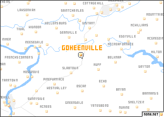
Goheenville (Pennsylvania, United States - USA)Goheenville is a town in the Pennsylvania region of United States - USA. An overview map of the region around Goheenville is displayed below.
regional and 3d topo map of Goheenville, United States - USA ::
Goheenville airports ::
The nearest airport is PIT - Pittsburgh (pennsylva) Pittsburgh Intl, located 86.1 km south west of Goheenville.
Other airports nearby include AOO - Altoona Blair Co (111.9 km south east), YNG - Youngstown Warren Rgnl (116.6 km west), IAD - Washington Dulles Intl (272.6 km south east), Nearby towns ::
Slabtown (3.7km south west) //
Mahoning Furnace (4.4km north) //
Muff (3.8km south east) //
Deanville (5.3km north west) //
Seminole (5.9km north east) //
Distant (7.1km north) //
Oscar (7.4km south) //
Putneyville (6.4km north east) //
Belknap (5.9km east) //
Echo (7.3km south east) //
Dee (6.8km north west) //
Climax (8.6km north) //
Pine Furnace (7.6km south west) //
Kellersburg (8.2km north west) //
West Valley (8.9km south west) //
[all distances 'as the bird flies' and approximate]  Places with similar names to Goheenville, United States - USA ::
// Kahâne Fal (SN)
Disclaimer :: Information on this page comes without warranty of any kind |
||
|
Where is Goheenville? Elevation and coordinates ::
Latitude (lat): 40°54'24"N Longitude (lon): 79°22'20"W
Elevation (approx.): 333m (map arrows pan, magnifying glasses zoom) |
||
|
Visiting Goheenville? Hotel/Accommodation ::
Book a hotel in Goheenville Travel Guide ::
rental cars ::
car rental offers GPS waypoint ::
download a GPX waypoint (PoI) of Goheenville for your GPS receiver
|
||