|
search place name
|
||
High Rue (Pennsylvania, United States - USA)High Rue is a town in the Pennsylvania region of United States - USA. An overview map of the region around High Rue is displayed below.
regional and 3d topo map of High Rue, United States - USA ::

High Rue airports ::
The nearest airport is NXX - Willow Grove Nas Jrb, located 16.7 km north west of High Rue.
Other airports nearby include PHL - Philadelphia Intl (28.4 km south west), TTN - Trenton Mercer (29.5 km north east), WRI - Wrightstown Mc Guire Afb (38.7 km east), NEL - Lakehurst Naes (58.6 km east), Nearby towns ::
Lagrange (0.2km north west) //
Bustleton (1.0km north east) //
Blue Grass (1.4km south east) //
Ashton Wooden Bridge (1.3km east) //
Holme Circle (2.3km south) //
Winchester Park (2.3km south) //
Vereeville (2.1km north west) //
Rhawnhurst (2.1km south west) //
Pauls Run (2.4km north) //
Lexington Park (2.5km south) //
Harrisburg (2.4km south east) //
Pennypack Woods (3.0km south east) //
Holmesburg (3.8km south) //
Torresdale (3.6km south east) //
Upper Holmesburg (4.0km south east) //
Wyndmoor Estates (4.0km north west) //
Valley Falls (4.3km north) //
Mayfair (4.6km south) //
Oxford Circle (4.0km south west) //
Fox Chase (3.7km west) //
Academy Garden (3.8km south east) //
Tacony (4.9km south) //
Philmont (5.0km north) //
Walnut Hill (4.2km north west) //
Burholme (4.2km west) //
Morrell Park (4.2km east) //
West Torresdale (4.2km east) //
Modena Park (4.3km east) //
Ryers (4.4km west) //
[all distances 'as the bird flies' and approximate] 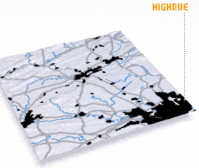 Places with similar names to High Rue, United States - USA ::
Disclaimer :: Information on this page comes without warranty of any kind |
||
|
Where is High Rue? Elevation and coordinates ::
Latitude (lat): 40°4'30"N Longitude (lon): 75°2'18"W
Elevation (approx.): 33m (map arrows pan, magnifying glasses zoom) |
||
|
Visiting High Rue? Hotel/Accommodation ::
Book a hotel in High Rue Travel Guide ::
rental cars ::
car rental offers GPS waypoint ::
download a GPX waypoint (PoI) of High Rue for your GPS receiver
|
||