|
search place name
|
||
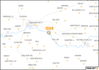
Iowa (Pennsylvania, United States - USA)Iowa is a town in the Pennsylvania region of United States - USA. An overview map of the region around Iowa is displayed below.
regional and 3d topo map of Iowa, United States - USA ::
Iowa airports ::
The nearest airport is AOO - Altoona Blair Co, located 108.7 km south east of Iowa.
Other airports nearby include PIT - Pittsburgh (pennsylva) Pittsburgh Intl (125.0 km south west), YNG - Youngstown Warren Rgnl (141.0 km west), BUF - Buffalo Niagara Intl (203.1 km north), IAG - Niagara Falls Intl (220.4 km north), Nearby towns ::
Emerickville (1.9km north east) //
Fuller (3.5km south east) //
Knox Dale (4.5km south) //
Sulger (5.1km north east) //
Tait (5.0km south west) //
Port Barnett (5.1km north west) //
Pinecreek (5.8km north west) //
Meredith (6.2km south east) //
Green Valley (7.5km south) //
North Sulger (7.1km north east) //
Ramsaytown (6.9km south west) //
Colon (6.6km south west) //
O'Donnell (6.6km south east) //
Barnes (6.3km west) //
Deemers Crossroads (6.7km east) //
Brookville (7.6km north west) //
[all distances 'as the bird flies' and approximate]  Places with similar names to Iowa, United States - USA ::
Disclaimer :: Information on this page comes without warranty of any kind |
||
|
Where is Iowa? Elevation and coordinates ::
Latitude (lat): 41°7'26"N Longitude (lon): 79°0'28"W
Elevation (approx.): 401m (map arrows pan, magnifying glasses zoom) |
||
|
Visiting Iowa? Hotel/Accommodation ::
Book a hotel in Iowa Travel Guide ::
rental cars ::
car rental offers GPS waypoint ::
download a GPX waypoint (PoI) of Iowa for your GPS receiver
|
||