|
search place name
|
||
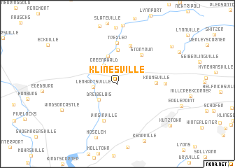
Klinesville (Pennsylvania, United States - USA)Klinesville is a town in the Pennsylvania region of United States - USA. An overview map of the region around Klinesville is displayed below.
regional and 3d topo map of Klinesville, United States - USA ::
Klinesville airports ::
The nearest airport is MUI - Muir Aaf, located 62.7 km west of Klinesville.
Other airports nearby include NXX - Willow Grove Nas Jrb (73.1 km south east), MDT - Harrisburg Intl (88.2 km south west), PHL - Philadelphia Intl (94.0 km south east), TTN - Trenton Mercer (94.3 km east), Nearby towns ::
Greenawald (3.4km north west) //
Dreibelbis (3.3km south west) //
Lenhartsville (3.0km west) //
Albany (4.6km north) //
Kempton (5.5km north) //
Stony Run (5.5km north east) //
Krumsville (4.7km east) //
Virginville (6.1km south) //
Fetherolfsville (6.3km north) //
Trexler (6.5km north) //
Grimville (5.8km east) //
Moselem (8.9km south) //
Schneidersville (8.9km north east) //
Kutztown (9.2km south east) //
[all distances 'as the bird flies' and approximate] 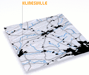 Places with similar names to Klinesville, United States - USA ::
// Collinsville (US)
// Collinsville (US)
// Collinsville (US)
// Collinsville (US)
// Collinsville (US)
// Glenns Valley (US)
// Collinsville (US)
// Collinsville (US)
// Klinesville (US)
// Collinsville (US)
Disclaimer :: Information on this page comes without warranty of any kind |
||
|
Where is Klinesville? Elevation and coordinates ::
Latitude (lat): 40°34'37"N Longitude (lon): 75°51'12"W
Elevation (approx.): 136m (map arrows pan, magnifying glasses zoom) |
||
|
Visiting Klinesville? Hotel/Accommodation ::
Book a hotel in Klinesville Travel Guide ::
rental cars ::
car rental offers GPS waypoint ::
download a GPX waypoint (PoI) of Klinesville for your GPS receiver
|
||