|
search place name
|
||
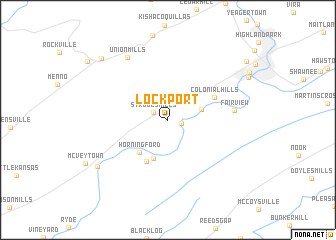
Lockport (Pennsylvania, United States - USA)Lockport is a town in the Pennsylvania region of United States - USA. An overview map of the region around Lockport is displayed below.
regional and 3d topo map of Lockport, United States - USA ::
Lockport airports ::
The nearest airport is AOO - Altoona Blair Co, located 62.4 km south west of Lockport.
Other airports nearby include MDT - Harrisburg Intl (85.4 km south east), MUI - Muir Aaf (93.2 km east), IPT - Williamsport Rgnl (99.5 km north east), BWI - Baltimore Washington Intl (173.9 km south east), Nearby towns ::
Anderson (1.2km east) //
Strodes Mills (1.5km north west) //
Granville (3.1km north east) //
Longfellow (4.5km south) //
Horningford (4.4km south west) //
Pine Glen (4.9km south) //
Colonial Hills (4.7km north east) //
Fairview (5.8km east) //
Union Mills (7.8km north west) //
Mattawana (7.9km south west) //
Belleville (8.9km north west) //
Klondyke (9.3km north east) //
[all distances 'as the bird flies' and approximate] 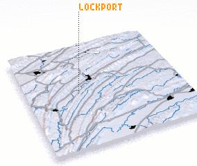 Places with similar names to Lockport, United States - USA ::
// Lake Purdy (US)
// Lakeport (US)
// Lakeport (US)
// Lakeport (US)
// Lockport (US)
// Lockport (US)
// Lagoa Parada (PT)
// Lockport (US)
// Lockport (US)
// Lakeport (US)
Disclaimer :: Information on this page comes without warranty of any kind |
||
|
Where is Lockport? Elevation and coordinates ::
Latitude (lat): 40°32'35"N Longitude (lon): 77°39'33"W
Elevation (approx.): 185m (map arrows pan, magnifying glasses zoom) |
||
|
Visiting Lockport? Hotel/Accommodation ::
Book a hotel in Lockport Travel Guide ::
rental cars ::
car rental offers GPS waypoint ::
download a GPX waypoint (PoI) of Lockport for your GPS receiver
|
||