|
search place name
|
||
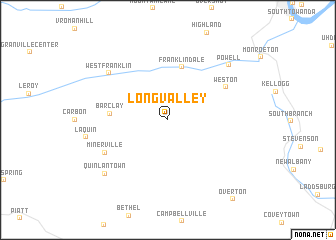
Long Valley (Pennsylvania, United States - USA)Long Valley is a town in the Pennsylvania region of United States - USA. An overview map of the region around Long Valley is displayed below.
regional and 3d topo map of Long Valley, United States - USA ::
Long Valley airports ::
The nearest airport is IPT - Williamsport Rgnl, located 54.0 km south west of Long Valley.
Other airports nearby include MUI - Muir Aaf (134.9 km south), MDT - Harrisburg Intl (162.5 km south), SYR - Syracuse Hancock Intl (166.7 km north), ROC - Greater Rochester Intl (186.8 km north west), Nearby towns ::
Franklindale (6.0km north) //
Barclay (4.9km west) //
Weston (6.1km north east) //
Minerville (6.4km south west) //
West Franklin (7.2km north west) //
Powell (7.9km north east) //
Quinlantown (8.0km south west) //
Overton (10.4km south east) //
[all distances 'as the bird flies' and approximate]  Places with similar names to Long Valley, United States - USA ::
// Long Valley (US)
// Longvale (US)
// Longville (US)
// Linkville (US)
// Longville (US)
// Longfellow (US)
// Longville (US)
// Linkville (US)
// Longville (US)
// Linkville (US)
Disclaimer :: Information on this page comes without warranty of any kind |
||
|
Where is Long Valley? Elevation and coordinates ::
Latitude (lat): 41°38'59"N Longitude (lon): 76°34'6"W
Elevation (approx.): 354m (map arrows pan, magnifying glasses zoom) |
||
|
Visiting Long Valley? Hotel/Accommodation ::
Book a hotel in Long Valley Travel Guide ::
rental cars ::
car rental offers GPS waypoint ::
download a GPX waypoint (PoI) of Long Valley for your GPS receiver
|
||