|
search place name
|
||
Niles Valley (Pennsylvania, United States - USA)Niles Valley is a town in the Pennsylvania region of United States - USA. An overview map of the region around Niles Valley is displayed below.
regional and 3d topo map of Niles Valley, United States - USA ::

Niles Valley airports ::
The nearest airport is IPT - Williamsport Rgnl, located 71.6 km south east of Niles Valley.
Other airports nearby include ROC - Greater Rochester Intl (147.2 km north), MUI - Muir Aaf (165.8 km south), BUF - Buffalo Niagara Intl (171.8 km north west), SYR - Syracuse Hancock Intl (172.8 km north east), Nearby towns ::
Middlebury Center (2.3km north east) //
Keeneyville (4.2km north) //
Wellsboro Junction (4.4km south) //
Stokesdale (5.6km south) //
Crooked Creek (5.4km north east) //
Shinglebury (7.5km north) //
Christian Hill (6.0km north west) //
Charleston (7.2km south east) //
Wellsboro (8.6km south) //
Shortsville (7.6km north west) //
Heise Run (8.3km south west) //
[all distances 'as the bird flies' and approximate] 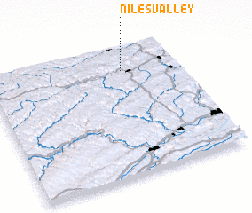 Places with similar names to Niles Valley, United States - USA ::
// Nilesville (US)
// Neelsville (US)
// Nellsville (US)
// Knowlesville (US)
// Neelysville (US)
// Nielsville (US)
// Knellsville (US)
// Neillsville (US)
Disclaimer :: Information on this page comes without warranty of any kind |
||
|
Where is Niles Valley? Elevation and coordinates ::
Latitude (lat): 41°49'30"N Longitude (lon): 77°17'16"W
Elevation (approx.): 362m (map arrows pan, magnifying glasses zoom) |
||
|
Visiting Niles Valley? Hotel/Accommodation ::
Book a hotel in Niles Valley Travel Guide ::
rental cars ::
car rental offers GPS waypoint ::
download a GPX waypoint (PoI) of Niles Valley for your GPS receiver
|
||