|
search place name
|
||
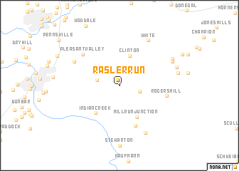
Rasler Run (Pennsylvania, United States - USA)Rasler Run is a town in the Pennsylvania region of United States - USA. An overview map of the region around Rasler Run is displayed below.
regional and 3d topo map of Rasler Run, United States - USA ::
Rasler Run airports ::
The nearest airport is PIT - Pittsburgh (pennsylva) Pittsburgh Intl, located 83.8 km north west of Rasler Run.
Other airports nearby include AOO - Altoona Blair Co (103.7 km east), EKN - Elkins Randolph Co Jennings Randolph (128.4 km south), YNG - Youngstown Warren Rgnl (172.3 km north west), AKR - Akron Fulton Intl (203.7 km north west), Nearby towns ::
Normalville (2.7km east) //
Pleasant Hill (2.7km west) //
Clinton (4.8km north) //
Mill Run Junction (5.3km south east) //
Indian Creek (5.2km south west) //
Mill Run (6.6km south) //
Pleasant Valley (6.6km north west) //
Rogers Mill (5.9km east) //
Breakneck (6.5km north west) //
White (7.8km north east) //
Fairmont (8.0km south east) //
Davistown (7.4km north east) //
Sagamore (7.3km east) //
Romney (7.7km north east) //
[all distances 'as the bird flies' and approximate] 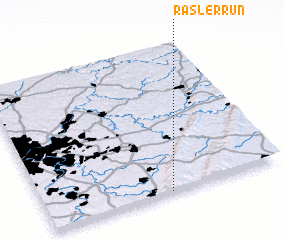 Places with similar names to Rasler Run, United States - USA ::
Disclaimer :: Information on this page comes without warranty of any kind |
||
|
Where is Rasler Run? Elevation and coordinates ::
Latitude (lat): 40°0'27"N Longitude (lon): 79°28'40"W
Elevation (approx.): 512m (map arrows pan, magnifying glasses zoom) |
||
|
Visiting Rasler Run? Hotel/Accommodation ::
Book a hotel in Rasler Run Travel Guide ::
rental cars ::
car rental offers GPS waypoint ::
download a GPX waypoint (PoI) of Rasler Run for your GPS receiver
|
||