|
search place name
|
||
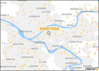
Shadyside (Pennsylvania, United States - USA)Shadyside is a town in the Pennsylvania region of United States - USA. An overview map of the region around Shadyside is displayed below.
regional and 3d topo map of Shadyside, United States - USA ::
Shadyside airports ::
The nearest airport is PIT - Pittsburgh (pennsylva) Pittsburgh Intl, located 25.1 km west of Shadyside.
Other airports nearby include YNG - Youngstown Warren Rgnl (109.3 km north west), AOO - Altoona Blair Co (138.7 km east), AKR - Akron Fulton Intl (144.4 km north west), EKN - Elkins Randolph Co Jennings Randolph (173.6 km south), Nearby towns ::
Bellefield (0.5km south) //
Bloomfield (1.3km north west) //
Schenley Heights (1.5km west) //
Point Breeze (1.7km east) //
East Liberty (1.8km north east) //
Oakland (2.1km south west) //
Squirrel Hill (2.4km south east) //
Lawrenceville (2.4km north west) //
Stanton Heights (3.0km north) //
Highland (2.9km north east) //
Greenfield (3.3km south) //
Homewood (2.8km east) //
Morningside (3.6km north) //
Hazelwood (4.2km south) //
Hill Distrct (3.3km west) //
Troy Hill (3.7km north west) //
Strip District (3.7km west) //
Soho (3.8km south west) //
Sharpsburg (4.9km north) //
Glenwood (5.1km south) //
Saint Clair (4.7km south west) //
Millvale (4.5km north west) //
Brushton (4.0km east) //
Belmar (4.2km north east) //
Cherry City (5.2km north) //
Park View (5.7km north) //
Sharpe Hill (5.8km north) //
Etna (5.9km north) //
Aspinwall (5.4km north east) //
[all distances 'as the bird flies' and approximate] 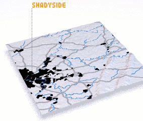 Places with similar names to Shadyside, United States - USA ::
// Shady Side (US)
// Shady Side (US)
// Siátista (GR)
// Chiţeşti (RO)
// Shadyside (US)
// Shady Side (US)
// Shadyside (US)
// Shadyside (US)
// Shadyside (US)
// Chhota Ghosta (BD)
Disclaimer :: Information on this page comes without warranty of any kind |
||
|
Where is Shadyside? Elevation and coordinates ::
Latitude (lat): 40°27'5"N Longitude (lon): 79°56'28"W
Elevation (approx.): 270m (map arrows pan, magnifying glasses zoom) |
||
|
Visiting Shadyside? Hotel/Accommodation ::
Book a hotel in Shadyside Travel Guide ::
rental cars ::
car rental offers GPS waypoint ::
download a GPX waypoint (PoI) of Shadyside for your GPS receiver
|
||