|
search place name
|
||
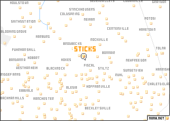
Sticks (Pennsylvania, United States - USA)Sticks is a town in the Pennsylvania region of United States - USA. An overview map of the region around Sticks is displayed below.
regional and 3d topo map of Sticks, United States - USA ::
Sticks airports ::
The nearest airport is MDT - Harrisburg Intl, located 49.7 km north of Sticks.
Other airports nearby include APG - Aberdeen Phillips Aaf (62.9 km south east), BWI - Baltimore Washington Intl (64.5 km south), MUI - Muir Aaf (79.0 km north), DCA - Ronald Reagan Washington Natl (101.4 km south), Nearby towns ::
Glenville (1.5km north west) //
Fiscal (2.3km south east) //
Pierceville (2.2km east) //
Mason Dixon Estates (3.1km south) //
Sugar Valley (3.1km south) //
Brodbecks (3.3km north west) //
Gunpowder Ridge (3.6km south west) //
Vangline Acres (4.1km south) //
Hokes (3.2km west) //
Young Mans Fancy (4.1km south) //
Mill Stream Hills (4.2km south) //
Saint Pauls (4.2km south) //
Walkers Run (4.2km south east) //
Rockville (4.3km north east) //
Stiltz (4.4km south east) //
Lineboro (4.6km south west) //
Bonnair (4.2km east) //
Gunpowder Acres (5.2km south east) //
Roller (5.6km south) //
Hildebrand (4.4km east) //
Mikules Manor (5.3km south east) //
Middletown Estates (5.5km south east) //
Leatherwood (5.9km south west) //
Blackrock (5.6km south west) //
Middletown Downs (6.1km south east) //
Alesia Heights (7.1km south) //
Wine Bel Valley (6.5km south west) //
Webers Ridge (6.4km south west) //
Pentland (6.5km north west) //
[all distances 'as the bird flies' and approximate] 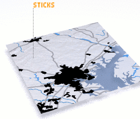 Places with similar names to Sticks, United States - USA ::
Disclaimer :: Information on this page comes without warranty of any kind |
||
|
Where is Sticks? Elevation and coordinates ::
Latitude (lat): 39°44'49"N Longitude (lon): 76°48'16"W
Elevation (approx.): 261m (map arrows pan, magnifying glasses zoom) |
||
|
Visiting Sticks? Hotel/Accommodation ::
Book a hotel in Sticks Travel Guide ::
rental cars ::
car rental offers GPS waypoint ::
download a GPX waypoint (PoI) of Sticks for your GPS receiver
|
||