|
search place name
|
||
Sundy Place (Pennsylvania, United States - USA)Sundy Place is a town in the Pennsylvania region of United States - USA. An overview map of the region around Sundy Place is displayed below.
regional and 3d topo map of Sundy Place, United States - USA ::

Sundy Place airports ::
The nearest airport is MDT - Harrisburg Intl, located 60.2 km east of Sundy Place.
Other airports nearby include AOO - Altoona Blair Co (73.0 km west), MUI - Muir Aaf (77.7 km east), IPT - Williamsport Rgnl (116.2 km north east), BWI - Baltimore Washington Intl (140.2 km south east), Nearby towns ::
McCrea (4.3km south) //
Doubling Gap (3.6km east) //
Couchtown (4.9km north) //
Andersonburg (7.8km north) //
Mount Hope (8.0km south) //
Blain (7.8km north west) //
Cisna Run (8.5km north) //
Washington (8.8km south) //
Centre (9.6km north east) //
[all distances 'as the bird flies' and approximate] 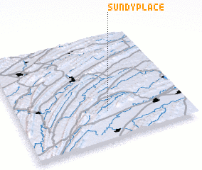 Places with similar names to Sundy Place, United States - USA ::
// Saint Pauls (ZA)
// Saint Pauls (ZA)
// Saint Pauls (US)
// Saint Pauls (US)
// Saint Pauls (US)
// Saint Pauls (JM)
// Saint-Palais (FR)
// Saint-Palais (FR)
// Saint-Palais (FR)
// Saint-Palais (FR)
Disclaimer :: Information on this page comes without warranty of any kind |
||
|
Where is Sundy Place? Elevation and coordinates ::
Latitude (lat): 40°16'48"N Longitude (lon): 77°27'42"W
Elevation (approx.): 339m (map arrows pan, magnifying glasses zoom) |
||
|
Visiting Sundy Place? Hotel/Accommodation ::
Book a hotel in Sundy Place Travel Guide ::
rental cars ::
car rental offers GPS waypoint ::
download a GPX waypoint (PoI) of Sundy Place for your GPS receiver
|
||