|
search place name
|
||
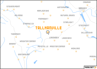
Tallmanville (Pennsylvania, United States - USA)Tallmanville is a town in the Pennsylvania region of United States - USA. An overview map of the region around Tallmanville is displayed below.
regional and 3d topo map of Tallmanville, United States - USA ::
Tallmanville airports ::
The nearest airport is SWF - Newburgh Stewart Intl, located 115.5 km east of Tallmanville.
Other airports nearby include IPT - Williamsport Rgnl (144.8 km south west), SYR - Syracuse Hancock Intl (149.3 km north west), TEB - Teterboro (159.7 km south east), ALB - Albany Intl (163.9 km north east), Nearby towns ::
Shehawken (2.0km north) //
Lakewood (2.9km south east) //
Preston Park (3.9km east) //
Fairmount (5.1km north) //
Poyntelle (6.0km south) //
Preston Corner (6.4km south east) //
Scott Center (7.4km north) //
Lake Como (5.9km south east) //
Starrucca (6.5km north west) //
Orson (7.6km south west) //
Maple Grove (8.2km north) //
Starlight (6.9km north east) //
Wrighter Corner (6.9km south west) //
East Spruce (7.0km south east) //
Autumn Leaves (8.4km north east) //
[all distances 'as the bird flies' and approximate]  Places with similar names to Tallmanville, United States - USA ::
// Toulminville (US)
Disclaimer :: Information on this page comes without warranty of any kind |
||
|
Where is Tallmanville? Elevation and coordinates ::
Latitude (lat): 41°52'21"N Longitude (lon): 75°24'8"W
Elevation (approx.): 531m (map arrows pan, magnifying glasses zoom) |
||
|
Visiting Tallmanville? Hotel/Accommodation ::
Book a hotel in Tallmanville Travel Guide ::
rental cars ::
car rental offers GPS waypoint ::
download a GPX waypoint (PoI) of Tallmanville for your GPS receiver
|
||