|
search place name
|
||
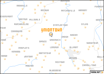
Uniontown (Pennsylvania, United States - USA)Uniontown is a town in the Pennsylvania region of United States - USA. An overview map of the region around Uniontown is displayed below.
regional and 3d topo map of Uniontown, United States - USA ::
Uniontown airports ::
The nearest airport is AOO - Altoona Blair Co, located 62.7 km south east of Uniontown.
Other airports nearby include PIT - Pittsburgh (pennsylva) Pittsburgh Intl (121.0 km west), YNG - Youngstown Warren Rgnl (167.3 km west), IPT - Williamsport Rgnl (171.4 km east), EKN - Elkins Randolph Co Jennings Randolph (219.9 km south west), Nearby towns ::
Greenwich (2.4km south east) //
McKeages Crossing (2.4km north east) //
Cherry Tree (3.1km north east) //
Garmantown (3.4km south east) //
Cush Cushion Crossing (3.3km north west) //
Spruce (3.6km south west) //
Stifflertown (4.0km north east) //
Long Run (4.9km south) //
Emeigh (3.8km east) //
North Barnesboro (5.1km south east) //
Marsteller (6.3km south) //
Bowdertown (6.4km north) //
West Branch (6.1km south east) //
Martintown (7.2km south) //
Northern Cambria (6.5km south east) //
Cush Creek (7.7km north) //
Hillsdale (7.0km north west) //
Shazen (6.1km east) //
Grisemore (7.6km south west) //
Fleming Summit (6.6km west) //
Alverda (8.6km south) //
Arcadia (8.7km north) //
Allport (7.8km south east) //
Mentcle (8.7km south west) //
Patchinville (9.6km north east) //
Wilgus (9.9km north west) //
Watkins (10.5km south east) //
Jewtown (10.3km south west) //
[all distances 'as the bird flies' and approximate] 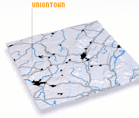 Places with similar names to Uniontown, United States - USA ::
Disclaimer :: Information on this page comes without warranty of any kind |
||
|
Where is Uniontown? Elevation and coordinates ::
Latitude (lat): 40°42'17"N Longitude (lon): 78°49'51"W
Elevation (approx.): 486m (map arrows pan, magnifying glasses zoom) |
||
|
Visiting Uniontown? Hotel/Accommodation ::
Book a hotel in Uniontown Travel Guide ::
rental cars ::
car rental offers GPS waypoint ::
download a GPX waypoint (PoI) of Uniontown for your GPS receiver
|
||