|
search place name
|
||
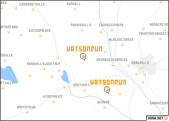
Watson Run (Pennsylvania, United States - USA)Watson Run is a town in the Pennsylvania region of United States - USA. An overview map of the region around Watson Run is displayed below.
regional and 3d topo map of Watson Run, United States - USA ::
Watson Run airports ::
The nearest airport is YNG - Youngstown Warren Rgnl, located 55.9 km south west of Watson Run.
Other airports nearby include AKR - Akron Fulton Intl (121.8 km south west), PIT - Pittsburgh (pennsylva) Pittsburgh Intl (129.3 km south), CLE - Cleveland Hopkins Intl (135.0 km west), YXU - London (169.9 km north west), Nearby towns ::
Dennys Corners (3.9km north east) //
Harmonsburg (4.5km west) //
Conneaut Lake Park (4.7km south west) //
Onspaugh Corners (4.7km east) //
West Vernon (6.5km south) //
Norrisville (6.7km north) //
Littles Corners (6.9km north east) //
Conneaut Lake (6.7km south west) //
Lynces Junction (6.5km south west) //
Watson Run (8.3km south east) //
Blacks Corner (7.2km north east) //
Coons Corners (8.1km north east) //
Keborts Corners (9.4km south east) //
[all distances 'as the bird flies' and approximate] 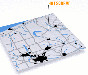 Places with similar names to Watson Run, United States - USA ::
// Watson Run (US)
Disclaimer :: Information on this page comes without warranty of any kind |
||
|
Where is Watson Run? Elevation and coordinates ::
Latitude (lat): 41°39'20"N Longitude (lon): 80°15'53"W
Elevation (approx.): 385m (map arrows pan, magnifying glasses zoom) |
||
|
Visiting Watson Run? Hotel/Accommodation ::
Book a hotel in Watson Run Travel Guide ::
rental cars ::
car rental offers GPS waypoint ::
download a GPX waypoint (PoI) of Watson Run for your GPS receiver
|
||