|
search place name
|
||
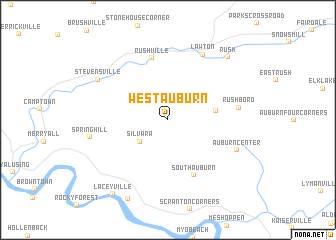
West Auburn (Pennsylvania, United States - USA)West Auburn is a town in the Pennsylvania region of United States - USA. An overview map of the region around West Auburn is displayed below.
regional and 3d topo map of West Auburn, United States - USA ::
West Auburn airports ::
The nearest airport is IPT - Williamsport Rgnl, located 86.3 km south west of West Auburn.
Other airports nearby include MUI - Muir Aaf (148.0 km south), SYR - Syracuse Hancock Intl (154.5 km north), MDT - Harrisburg Intl (178.3 km south), NXX - Willow Grove Nas Jrb (187.1 km south east), Nearby towns ::
Silvara (3.4km south west) //
Retta (4.1km east) //
South Auburn (6.5km south) //
Rushville (7.0km north) //
Rushboro (6.1km east) //
Lawton (7.9km north) //
Auburn Center (6.7km south east) //
Spring Hill (6.8km west) //
Stevensville (7.3km north west) //
Rush (8.6km north east) //
Skinners Eddy (9.4km south) //
Laceyville (9.5km south west) //
[all distances 'as the bird flies' and approximate] 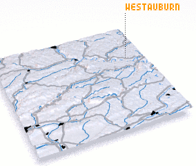 Places with similar names to West Auburn, United States - USA ::
// West Auburn (US)
// West Auburn (US)
// West Berne (US)
// Westbourne (US)
// Westbourne (US)
// Westbourne (GB)
// Westbourne (CA)
Disclaimer :: Information on this page comes without warranty of any kind |
||
|
Where is West Auburn? Elevation and coordinates ::
Latitude (lat): 41°43'13"N Longitude (lon): 76°6'24"W
Elevation (approx.): 297m (map arrows pan, magnifying glasses zoom) |
||
|
Visiting West Auburn? Hotel/Accommodation ::
Book a hotel in West Auburn Travel Guide ::
rental cars ::
car rental offers GPS waypoint ::
download a GPX waypoint (PoI) of West Auburn for your GPS receiver
|
||