|
search place name
|
||
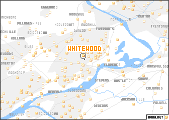
Whitewood (Pennsylvania, United States - USA)Whitewood is a town in the Pennsylvania region of United States - USA. An overview map of the region around Whitewood is displayed below.
regional and 3d topo map of Whitewood, United States - USA ::
Whitewood airports ::
The nearest airport is TTN - Trenton Mercer, located 15.8 km north of Whitewood.
Other airports nearby include NXX - Willow Grove Nas Jrb (25.3 km west), WRI - Wrightstown Mc Guire Afb (26.9 km south east), PHL - Philadelphia Intl (43.9 km south west), NEL - Lakehurst Naes (45.0 km east), Nearby towns ::
Indian Creek (0.7km north west) //
Blue Ridge (1.0km south) //
Goldenridge (1.0km north east) //
Yellowood (1.2km south) //
Violet Wood (1.1km east) //
Mill Creek Falls (1.2km south west) //
Quincy Hollow (1.6km north) //
Wood (1.3km east) //
Emilie (1.7km north) //
Cobalt Ridge (2.0km north) //
Red Cedar Hill (2.0km north east) //
Margo Gardens (2.2km south) //
Bristol Terrace Number Two (2.3km south) //
Dogwood Hollow (1.9km east) //
Oaktree Hollow (2.0km north east) //
Upper Emilie (2.6km north east) //
Farmbrook (2.3km east) //
Bristol Terrace Number One (2.9km south) //
Midway (2.4km west) //
Appletree Hill (2.8km north east) //
Greenbrook (2.5km east) //
Edgely (2.6km south east) //
Crabtree Hollow (2.9km north east) //
Elmwood Terrace (3.4km north) //
Bath Addition (3.6km south) //
Holly Hill (3.2km north east) //
Stonybrook (3.0km north east) //
Winder Village (3.8km south) //
Levittown (3.3km north east) //
[all distances 'as the bird flies' and approximate]  Places with similar names to Whitewood, United States - USA ::
Disclaimer :: Information on this page comes without warranty of any kind |
||
|
Where is Whitewood? Elevation and coordinates ::
Latitude (lat): 40°8'22"N Longitude (lon): 74°51'44"W
Elevation (approx.): 24m (map arrows pan, magnifying glasses zoom) |
||
|
Visiting Whitewood? Hotel/Accommodation ::
Book a hotel in Whitewood Travel Guide ::
rental cars ::
car rental offers GPS waypoint ::
download a GPX waypoint (PoI) of Whitewood for your GPS receiver
|
||