|
search place name
|
||
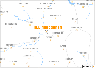
Williams Corner (Pennsylvania, United States - USA)Williams Corner is a town in the Pennsylvania region of United States - USA. An overview map of the region around Williams Corner is displayed below.
regional and 3d topo map of Williams Corner, United States - USA ::
Williams Corner airports ::
The nearest airport is IPT - Williamsport Rgnl, located 113.8 km south west of Williams Corner.
Other airports nearby include SYR - Syracuse Hancock Intl (140.9 km north), SWF - Newburgh Stewart Intl (149.1 km east), MUI - Muir Aaf (169.8 km south), TEB - Teterboro (185.8 km south east), Nearby towns ::
Tiffany (2.6km south) //
Heart Lake (3.2km east) //
Montrose (4.7km south west) //
Franklin Forks (6.7km north) //
Upsonville (6.6km north) //
Fisk Mill (6.2km north west) //
Alford (7.5km south east) //
Lawsville Center (8.9km north) //
South Montrose (8.5km south west) //
[all distances 'as the bird flies' and approximate] 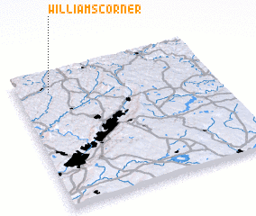 Places with similar names to Williams Corner, United States - USA ::
Disclaimer :: Information on this page comes without warranty of any kind |
||
|
Where is Williams Corner? Elevation and coordinates ::
Latitude (lat): 41°51'32"N Longitude (lon): 75°49'54"W
Elevation (approx.): 432m (map arrows pan, magnifying glasses zoom) |
||
|
Visiting Williams Corner? Hotel/Accommodation ::
Book a hotel in Williams Corner Travel Guide ::
rental cars ::
car rental offers GPS waypoint ::
download a GPX waypoint (PoI) of Williams Corner for your GPS receiver
|
||