|
search place name
|
||
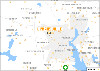
Lymansville (Rhode Island, United States - USA)Lymansville is a town in the Rhode Island region of United States - USA. An overview map of the region around Lymansville is displayed below.
regional and 3d topo map of Lymansville, United States - USA ::
nearby GPS traces from timatio ::
Lymansville airports ::
The nearest airport is PVD - Providence Theodore Francis Green State, located 12.9 km south of Lymansville.
Other airports nearby include BOS - Boston General Edward Lawrence Logan Intl (69.8 km north east), BED - Bedford Laurence G Hanscom Fld (71.5 km north), CEF - Chicopee Falls Westover Arb Metropolitan (96.3 km north west), HFD - Hartford Brainard (98.5 km west), Nearby towns ::
Manton (0.7km south east) //
Allendale (1.0km north) //
North Providence (1.1km north east) //
Fruit Hill (1.3km north east) //
Centerdale (1.7km north) //
Dyerville (2.1km south east) //
Merino (2.3km south) //
Greystone (3.1km north west) //
Geneva (3.0km north east) //
Woodville (3.2km north east) //
Olneyville (3.7km south east) //
Wanskuck (3.3km north east) //
Esmond (3.9km north west) //
Hughesdale (4.1km south west) //
Marieville (4.4km north east) //
Thornton (5.3km south) //
Simmonsville (5.1km south west) //
Georgiaville (5.9km north west) //
Christian Hill (5.3km south east) //
Knightsville (6.7km south) //
Fountain Spring (5.4km north west) //
Providence (5.3km east) //
Elmwood (6.2km south east) //
Wayland (7.2km south) //
Fairlawn (6.3km north east) //
Cranston (7.5km south east) //
Saylesville Highlands (7.0km north east) //
Meshanticut (8.3km south) //
Foxes Hill (6.6km south east) //
[all distances 'as the bird flies' and approximate] 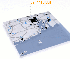 Places with similar names to Lymansville, United States - USA ::
Disclaimer :: Information on this page comes without warranty of any kind |
||
|
Where is Lymansville? Elevation and coordinates ::
Latitude (lat): 41°50'29"N Longitude (lon): 71°28'23"W
Elevation (approx.): 35m (map arrows pan, magnifying glasses zoom) |
||
|
Visiting Lymansville? Hotel/Accommodation ::
Book a hotel in Lymansville Travel Guide ::
rental cars ::
car rental offers GPS waypoint ::
download a GPX waypoint (PoI) of Lymansville for your GPS receiver
|
||