|
search place name
|
||
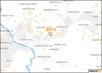
Bath (South Carolina, United States - USA)Bath is a town in the South Carolina region of United States - USA. An overview map of the region around Bath is displayed below.
regional and 3d topo map of Bath, United States - USA ::
Bath airports ::
The nearest airport is AGS - Bush Field Augusta Rgnl At Bush Fld, located 17.4 km south west of Bath.
Other airports nearby include CAE - Colombia Columbia Metropolitan (84.6 km north east), AND - Andersen Anderson Rgnl (134.5 km north west), SSC - Sumter Shaw Afb (139.6 km east), NBC - Beaufort Mcas (156.3 km south east), Nearby towns ::
Lynwood (0.9km north east) //
Johnstown (1.5km south west) //
Ridgecrest (1.4km north west) //
Horse Creek (2.0km north west) //
Burnettown (2.2km north east) //
Clearwater (2.3km west) //
Jacksonville (2.4km east) //
Heathwood Park (2.8km north west) //
Langley (2.8km north east) //
Woodridge (3.1km west) //
Lakewood (3.2km north west) //
Storm Branch Park (3.4km south west) //
Belclear (3.5km north west) //
Langley Villa (3.8km east) //
Crestdale (4.0km west) //
Gloverville (4.3km north east) //
Lynns Ranchettes (5.0km south west) //
Willow Springs Park (4.6km north west) //
Russell Hill (5.1km south east) //
Augusta View Heights (4.7km west) //
Pembrook (6.0km south) //
Pinecrest (6.0km west) //
Sandlewood (6.6km north west) //
Ascaga Heights (7.0km north) //
Mixville (6.4km north east) //
Country Place (6.7km north west) //
Midland Valley (6.9km north east) //
Audubon Homes (6.3km west) //
Bradleyville (6.5km west) //
[all distances 'as the bird flies' and approximate]  Places with similar names to Bath, United States - USA ::
Disclaimer :: Information on this page comes without warranty of any kind |
||
|
Where is Bath? Elevation and coordinates ::
Latitude (lat): 33°30'16"N Longitude (lon): 81°52'9"W
Elevation (approx.): 51m (map arrows pan, magnifying glasses zoom) |
||
|
Visiting Bath? Hotel/Accommodation ::
Book a hotel in Bath Travel Guide ::
rental cars ::
car rental offers GPS waypoint ::
download a GPX waypoint (PoI) of Bath for your GPS receiver
|
||