|
search place name
|
||
Double Springs (South Carolina, United States - USA)Double Springs is a town in the South Carolina region of United States - USA. An overview map of the region around Double Springs is displayed below.
regional and 3d topo map of Double Springs, United States - USA ::

Double Springs airports ::
The nearest airport is AND - Andersen Anderson Rgnl, located 15.3 km east of Double Springs.
Other airports nearby include AGS - Bush Field Augusta Rgnl At Bush Fld (151.4 km south east), MGE - Marietta Dobbins Arb (Atlanta Nas) (164.6 km south west), ATL - Hartsfield Jackson Atlanta Intl (172.6 km south west), CAE - Colombia Columbia Metropolitan (173.6 km east), Nearby towns ::
Oakdale (4.2km north east) //
Fairfield Acres (4.8km east) //
Townville (7.0km north) //
Reed Creek (7.9km south west) //
Lakefront (7.4km east) //
The Shoals (7.7km east) //
Shadow Wood (8.7km north east) //
Rock Creek Acres (8.3km north east) //
Leisure Village (9.1km north east) //
[all distances 'as the bird flies' and approximate] 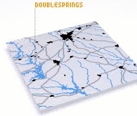 Places with similar names to Double Springs, United States - USA ::
// Double Springs (US)
// Double Springs (US)
// Double Springs (US)
// Double Springs (US)
// Double Springs (US)
// Double Springs (US)
Disclaimer :: Information on this page comes without warranty of any kind |
||
|
Where is Double Springs? Elevation and coordinates ::
Latitude (lat): 34°30'14"N Longitude (lon): 82°52'34"W
Elevation (approx.): 246m (map arrows pan, magnifying glasses zoom) |
||
|
Visiting Double Springs? Hotel/Accommodation ::
Book a hotel in Double Springs Travel Guide ::
rental cars ::
car rental offers GPS waypoint ::
download a GPX waypoint (PoI) of Double Springs for your GPS receiver
|
||