|
search place name
|
||
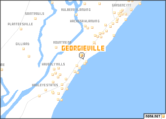
Georgieville (South Carolina, United States - USA)Georgieville is a town in the South Carolina region of United States - USA. An overview map of the region around Georgieville is displayed below.
regional and 3d topo map of Georgieville, United States - USA ::
Georgieville airports ::
The nearest airport is MYR - Myrtle Beach Intl, located 25.5 km north east of Georgieville.
Other airports nearby include FLO - Florence Rgnl (96.7 km north west), CHS - Charleston Afb Intl (110.5 km south west), SSC - Sumter Shaw Afb (138.6 km north west), ILM - Wilmington Intl (139.6 km north east), Nearby towns ::
North Litchfield Beach (0.8km south east) //
Litchfield Retreat (0.9km south) //
Annieville (1.8km south west) //
Litchfield by the Sea (2.0km south) //
Litchfield Beach (3.1km south) //
Salt Marsh Cove (3.2km south west) //
Huntington Marsh (4.1km north east) //
Inlet Oaks Village (4.4km north east) //
Mount Rena (4.7km north west) //
Parkersville (5.4km south west) //
Chapel Creek (5.0km south west) //
Oak Hill (5.9km north east) //
Captains Cove (5.9km north east) //
Woodville Acres (5.5km south west) //
Moss Creek (6.1km north east) //
Belin (5.8km north west) //
Pawleys Retreat (6.1km south west) //
Chapel Creek Villas (6.0km south west) //
Waverly Mills (5.9km west) //
Live Oaks (6.7km north east) //
Richmond Hill (7.1km north) //
Fraserville (6.8km south west) //
Wayside Forest (7.0km north east) //
Carriage Run (7.4km north) //
Wachesaw Landing (7.5km north) //
Pawleys Island (7.3km south west) //
River Oaks Estates (6.7km south west) //
Gray Mans Cove (7.6km south west) //
Murrells Inlet (7.8km north east) //
[all distances 'as the bird flies' and approximate] 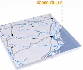 Places with similar names to Georgieville, United States - USA ::
// Georgeville (BZ)
// Georgiaville (US)
// Georgeville (US)
// Georgeville (US)
// Georgeville (US)
// Georgeville (US)
// Georgeville (US)
// Georgiaville (US)
// Georgeville (AU)
Disclaimer :: Information on this page comes without warranty of any kind |
||
|
Where is Georgieville? Elevation and coordinates ::
Latitude (lat): 33°29'35"N Longitude (lon): 79°5'21"W
Elevation (approx.): 5m (map arrows pan, magnifying glasses zoom) |
||
|
Visiting Georgieville? Hotel/Accommodation ::
Book a hotel in Georgieville Travel Guide ::
rental cars ::
car rental offers GPS waypoint ::
download a GPX waypoint (PoI) of Georgieville for your GPS receiver
|
||