|
search place name
|
||
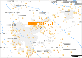
Hermitage Hills (South Carolina, United States - USA)Hermitage Hills is a town in the South Carolina region of United States - USA. An overview map of the region around Hermitage Hills is displayed below.
regional and 3d topo map of Hermitage Hills, United States - USA ::
Hermitage Hills airports ::
The nearest airport is AND - Andersen Anderson Rgnl, located 54.4 km south west of Hermitage Hills.
Other airports nearby include HKY - Hickory Rgnl (129.0 km north east), CLT - Charlotte Douglas Intl (132.7 km east), CAE - Colombia Columbia Metropolitan (153.0 km south east), AGS - Bush Field Augusta Rgnl At Bush Fld (170.7 km south), Nearby towns ::
McSwain Gardens (0.6km south east) //
Lake Forest (0.8km south) //
Spring Forest (0.8km south) //
Morningside (0.8km north) //
Wildaire (1.1km north west) //
Timberlake (1.2km south) //
Totany Woods (1.2km north) //
Willington Green (1.2km north east) //
Hudson Acres (1.5km south) //
Bird Fields (1.5km north west) //
Rogers Valley Heights (1.5km south east) //
Rosedale (1.6km north east) //
Green Hills (1.5km west) //
Forestdale Heights (1.8km north east) //
Watson Orchard (2.0km south east) //
Northwood (1.8km north east) //
Liberty Park (1.7km west) //
Kingsgate (1.8km east) //
Piney Ridge (2.0km north west) //
Broadmoor (2.0km north east) //
Stratton Place (2.0km south east) //
Wade Hampton Gardens (2.2km north west) //
Spring Forest (2.0km east) //
Cherokee Forest (2.4km north) //
Green Fields (2.1km east) //
Dellwood (2.1km west) //
North Side Heights (2.1km north west) //
Hampton Heights (2.6km north) //
Green Forest (2.5km north east) //
[all distances 'as the bird flies' and approximate] 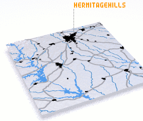 Places with similar names to Hermitage Hills, United States - USA ::
// Hermitage Hills (US)
// Hermitage Hills (US)
Disclaimer :: Information on this page comes without warranty of any kind |
||
|
Where is Hermitage Hills? Elevation and coordinates ::
Latitude (lat): 34°52'38"N Longitude (lon): 82°20'20"W
Elevation (approx.): 297m (map arrows pan, magnifying glasses zoom) |
||
|
Visiting Hermitage Hills? Hotel/Accommodation ::
Book a hotel in Hermitage Hills Travel Guide ::
rental cars ::
car rental offers GPS waypoint ::
download a GPX waypoint (PoI) of Hermitage Hills for your GPS receiver
|
||