|
search place name
|
||
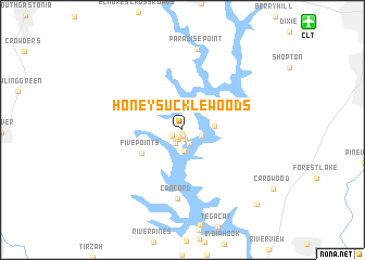
Honeysuckle Woods (South Carolina, United States - USA)Honeysuckle Woods is a town in the South Carolina region of United States - USA. An overview map of the region around Honeysuckle Woods is displayed below.
regional and 3d topo map of Honeysuckle Woods, United States - USA ::
Honeysuckle Woods airports ::
The nearest airport is CLT - Charlotte Douglas Intl, located 15.4 km north east of Honeysuckle Woods.
Other airports nearby include HKY - Hickory Rgnl (75.8 km north west), CAE - Colombia Columbia Metropolitan (130.4 km south), INT - Winston-salem Smith Reynolds (136.3 km north east), SSC - Sumter Shaw Afb (137.7 km south east), Nearby towns ::
Heritage Woods (0.3km south) //
Hollyberry Woods (0.7km south) //
River Hills Plantation (0.8km south west) //
Oakwood (1.0km south) //
Cedarwood (1.0km south) //
Fairway Bridge (1.1km south west) //
Timber Ridge (1.0km south west) //
Sunrise Point (1.5km south) //
Catawba Ridge (1.5km south west) //
Lake Wylie (1.7km east) //
South Point (2.1km south) //
Pine Harbor (2.8km east) //
Five Points (4.2km south west) //
Concord (7.1km south) //
Paradise Point (8.4km north) //
Grey Rock (9.9km south east) //
[all distances 'as the bird flies' and approximate] 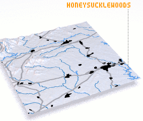 Places with similar names to Honeysuckle Woods, United States - USA :: Disclaimer :: Information on this page comes without warranty of any kind |
||
|
Where is Honeysuckle Woods? Elevation and coordinates ::
Latitude (lat): 35°6'49"N Longitude (lon): 81°3'37"W
Elevation (approx.): 212m (map arrows pan, magnifying glasses zoom) |
||
|
Visiting Honeysuckle Woods? Hotel/Accommodation ::
Book a hotel in Honeysuckle Woods Travel Guide ::
rental cars ::
car rental offers GPS waypoint ::
download a GPX waypoint (PoI) of Honeysuckle Woods for your GPS receiver
|
||