|
search place name
|
||
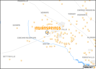
Indian Springs (South Carolina, United States - USA)Indian Springs is a town in the South Carolina region of United States - USA. An overview map of the region around Indian Springs is displayed below.
regional and 3d topo map of Indian Springs, United States - USA ::
Indian Springs airports ::
The nearest airport is CHS - Charleston Afb Intl, located 20.3 km south east of Indian Springs.
Other airports nearby include NBC - Beaufort Mcas (73.2 km south west), SSC - Sumter Shaw Afb (111.4 km north), SAV - Savannah Hilton Head Intl (132.2 km south west), CAE - Colombia Columbia Metropolitan (134.0 km north west), Nearby towns ::
Flowertown Village (0.8km north east) //
Slandsville (1.5km south west) //
Oakdale Estates (1.6km north east) //
Farmdale (1.9km south east) //
Summerville Farms (2.1km south east) //
Newington Plantation (2.2km east) //
Cotton Hill (2.5km north west) //
Knightsville (2.6km north) //
Country Club Estates (2.6km north east) //
Ashley Retreat (3.0km south west) //
Crestwood (3.0km south east) //
Woodland Estates (3.0km east) //
Salisbury Acres (3.1km east) //
Marlin Estates (3.1km east) //
Evergreen (3.2km east) //
Sweetbriar (3.7km north west) //
Pecan Grove (3.8km north) //
Trotters Ridge (4.0km north) //
Orchard Hill (4.1km north) //
Ashley Forest (3.7km south east) //
Creekside (3.6km south east) //
Huntington Farms (4.1km north) //
Dorchester Estates (3.8km south east) //
Barney Ridge (3.9km south east) //
White Church Place (4.2km south east) //
West Oaks (4.7km south) //
Quail Arbor (4.0km east) //
Westoe (4.8km south) //
Sprucewood (4.8km south) //
[all distances 'as the bird flies' and approximate] 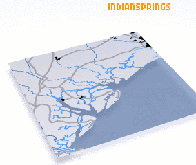 Places with similar names to Indian Springs, United States - USA ::
// Indian Springs (US)
// Indian Springs (US)
// Indian Springs (US)
// Indian Springs (US)
// Indian Springs (US)
// Indian Springs (US)
// Indian Springs (US)
// Indian Springs (US)
// Indian Springs (US)
// Indian Springs (US)
Disclaimer :: Information on this page comes without warranty of any kind |
||
|
Where is Indian Springs? Elevation and coordinates ::
Latitude (lat): 32°59'20"N Longitude (lon): 80°13'44"W
Elevation (approx.): 20m (map arrows pan, magnifying glasses zoom) |
||
|
Visiting Indian Springs? Hotel/Accommodation ::
Book a hotel in Indian Springs Travel Guide ::
rental cars ::
car rental offers GPS waypoint ::
download a GPX waypoint (PoI) of Indian Springs for your GPS receiver
|
||