|
search place name
|
||
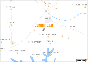
Juneville (South Carolina, United States - USA)Juneville is a town in the South Carolina region of United States - USA. An overview map of the region around Juneville is displayed below.
regional and 3d topo map of Juneville, United States - USA ::
Juneville airports ::
The nearest airport is SSC - Sumter Shaw Afb, located 41.7 km north west of Juneville.
Other airports nearby include FLO - Florence Rgnl (75.3 km north east), CHS - Charleston Afb Intl (85.6 km south), CAE - Colombia Columbia Metropolitan (88.1 km west), MYR - Myrtle Beach Intl (120.9 km east), Nearby towns ::
James Crossroads (2.8km south east) //
Halleytown (3.4km west) //
Country Club Estates (3.6km north east) //
Manning (4.9km north) //
Jordan (5.7km south) //
Davis Station (6.5km south west) //
Bloomville (6.8km east) //
[all distances 'as the bird flies' and approximate] 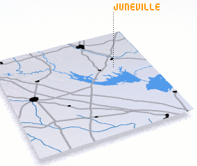 Places with similar names to Juneville, United States - USA ::
// Jaunvāle (LV)
// Genevilla (ES)
// Jenneville (US)
// Jānephal (IN)
// Gianvélia (GN)
// Genneville (FR)
// Jonval (FR)
// Jonvelle (FR)
// Juniville (FR)
// Genval (BE)
Disclaimer :: Information on this page comes without warranty of any kind |
||
|
Where is Juneville? Elevation and coordinates ::
Latitude (lat): 33°39'14"N Longitude (lon): 80°13'52"W
Elevation (approx.): 32m (map arrows pan, magnifying glasses zoom) |
||
|
Visiting Juneville? Hotel/Accommodation ::
Book a hotel in Juneville Travel Guide ::
rental cars ::
car rental offers GPS waypoint ::
download a GPX waypoint (PoI) of Juneville for your GPS receiver
|
||