|
search place name
|
||
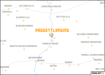
Padgett Landing (South Carolina, United States - USA)Padgett Landing is a town in the South Carolina region of United States - USA. An overview map of the region around Padgett Landing is displayed below.
regional and 3d topo map of Padgett Landing, United States - USA ::
Padgett Landing airports ::
The nearest airport is CHS - Charleston Afb Intl, located 34.1 km east of Padgett Landing.
Other airports nearby include NBC - Beaufort Mcas (50.8 km south west), SAV - Savannah Hilton Head Intl (109.6 km south west), SVN - Hunter Aaf (116.2 km south west), SSC - Sumter Shaw Afb (125.2 km north), Nearby towns ::
Martins Landing (0.5km south east) //
Pine Hill Landing (1.1km south) //
Parkers Ferry Landing (1.6km north) //
Lowndes Landing (2.6km north) //
Canady Landing (3.4km south) //
Beck Landing (4.9km south) //
Gettysville (7.1km north east) //
Clubhouse Crossroads (9.3km north east) //
Jacksonboro (9.8km south west) //
[all distances 'as the bird flies' and approximate] 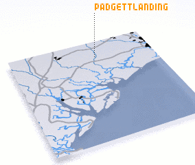 Places with similar names to Padgett Landing, United States - USA :: Disclaimer :: Information on this page comes without warranty of any kind |
||
|
Where is Padgett Landing? Elevation and coordinates ::
Latitude (lat): 32°50'43"N Longitude (lon): 80°23'59"W
Elevation (approx.): 12m (map arrows pan, magnifying glasses zoom) |
||
|
Visiting Padgett Landing? Hotel/Accommodation ::
Book a hotel in Padgett Landing Travel Guide ::
rental cars ::
car rental offers GPS waypoint ::
download a GPX waypoint (PoI) of Padgett Landing for your GPS receiver
|
||