|
search place name
|
||
Pauline (South Carolina, United States - USA)Pauline is a town in the South Carolina region of United States - USA. An overview map of the region around Pauline is displayed below.
regional and 3d topo map of Pauline, United States - USA ::

Pauline airports ::
The nearest airport is AND - Andersen Anderson Rgnl, located 85.4 km south west of Pauline.
Other airports nearby include CLT - Charlotte Douglas Intl (94.8 km north east), HKY - Hickory Rgnl (109.9 km north east), CAE - Colombia Columbia Metropolitan (121.0 km south east), SSC - Sumter Shaw Afb (160.4 km south east), Nearby towns ::
Golightly (2.9km north west) //
Glenn Springs (3.8km south east) //
Foster Mill (4.8km north east) //
Stone Station (5.1km west) //
Walnut Grove (5.8km south west) //
Woodwind (7.4km north) //
Windsor Forest (8.0km north) //
Smiths Tavern (7.0km north west) //
Huntington Hills (8.3km north) //
Camp Croft (8.8km north) //
Ponderosa Gardens (8.9km north) //
Rosewood (9.0km north) //
Canaan (8.6km north west) //
Pinedale Acres (9.1km north west) //
White Stone (9.2km north east) //
Raynell (8.9km north west) //
Calico (10.9km north east) //
[all distances 'as the bird flies' and approximate] 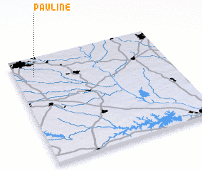 Places with similar names to Pauline, United States - USA ::
Disclaimer :: Information on this page comes without warranty of any kind |
||
|
Where is Pauline? Elevation and coordinates ::
Latitude (lat): 34°49'59"N Longitude (lon): 81°52'21"W
Elevation (approx.): 234m (map arrows pan, magnifying glasses zoom) |
||
|
Visiting Pauline? Hotel/Accommodation ::
Book a hotel in Pauline Travel Guide ::
rental cars ::
car rental offers GPS waypoint ::
download a GPX waypoint (PoI) of Pauline for your GPS receiver
|
||