|
search place name
|
||
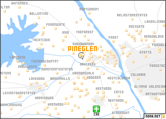
Pineglen (South Carolina, United States - USA)Pineglen is a town in the South Carolina region of United States - USA. An overview map of the region around Pineglen is displayed below.
regional and 3d topo map of Pineglen, United States - USA ::
Pineglen airports ::
The nearest airport is CAE - Colombia Columbia Metropolitan, located 11.4 km south of Pineglen.
Other airports nearby include SSC - Sumter Shaw Afb (62.9 km east), AGS - Bush Field Augusta Rgnl At Bush Fld (106.1 km south west), CLT - Charlotte Douglas Intl (131.6 km north), FLO - Florence Rgnl (132.3 km east), Nearby towns ::
Gardendale (0.8km east) //
Leaphart (0.9km north west) //
Seven Oaks (1.0km north) //
Grenadier (1.2km east) //
Whitehall (1.9km north) //
Saint Andrews (1.8km east) //
Landmark (1.9km north east) //
Oak Creek (2.2km south east) //
Woodland Hills (1.9km east) //
Hallmark (2.2km north west) //
Shadow Brook (2.7km north) //
Challedon (3.0km north) //
Quail Hollow (3.3km south east) //
Chartwell (3.2km east) //
Homewood Terrace (3.6km north east) //
Varnarsdale (3.9km south) //
Mandel Park (3.7km north east) //
Spring Lake (4.1km south) //
Challedon West (3.9km north west) //
Laurel Meadows (4.3km south) //
Cross Roads (3.7km east) //
Bonnie Forest (4.6km north) //
Brook Pines (4.2km north east) //
Mandel Hall (4.4km north east) //
St. Andrews (4.2km east) //
Walden (4.4km north west) //
The Forest (5.4km north) //
Dutchbrook (4.5km east) //
Greyland Forest (5.5km south) //
[all distances 'as the bird flies' and approximate] 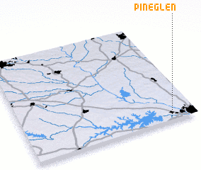 Places with similar names to Pineglen, United States - USA ::
Disclaimer :: Information on this page comes without warranty of any kind |
||
|
Where is Pineglen? Elevation and coordinates ::
Latitude (lat): 34°2'22"N Longitude (lon): 81°8'50"W
Elevation (approx.): 56m (map arrows pan, magnifying glasses zoom) |
||
|
Visiting Pineglen? Hotel/Accommodation ::
Book a hotel in Pineglen Travel Guide ::
rental cars ::
car rental offers GPS waypoint ::
download a GPX waypoint (PoI) of Pineglen for your GPS receiver
|
||