|
search place name
|
||
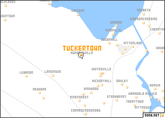
Tuckertown (South Carolina, United States - USA)Tuckertown is a town in the South Carolina region of United States - USA. An overview map of the region around Tuckertown is displayed below.
regional and 3d topo map of Tuckertown, United States - USA ::
Tuckertown airports ::
The nearest airport is CHS - Charleston Afb Intl, located 31.3 km south of Tuckertown.
Other airports nearby include SSC - Sumter Shaw Afb (94.8 km north), NBC - Beaufort Mcas (97.0 km south west), FLO - Florence Rgnl (117.3 km north), MYR - Myrtle Beach Intl (122.5 km north east), Nearby towns ::
Murraysville (0.6km north) //
Whitesville (4.9km south east) //
Oak Park (5.0km south east) //
The Barrows (5.2km south east) //
The Cottage (5.1km south east) //
Sugar Hill (6.2km north east) //
Saint Johns (6.8km south east) //
Hickory Hill (7.0km south east) //
Long Ridge (6.8km south west) //
Windwood (7.9km south) //
Forest Acres (8.0km south) //
Frazier Hill (7.3km north east) //
Pinopolis (8.1km north east) //
Wampee (9.8km north east) //
[all distances 'as the bird flies' and approximate] 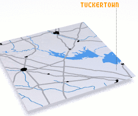 Places with similar names to Tuckertown, United States - USA ::
// Tuckertown (US)
// Dachrieden (DE)
// Teegarden (US)
// Dogordon (RU)
// Deh Gardān (IR)
// Tuckertown (US)
// Tuckerton (US)
// Deckertown (US)
// Deckertown (US)
// Teegarden (US)
Disclaimer :: Information on this page comes without warranty of any kind |
||
|
Where is Tuckertown? Elevation and coordinates ::
Latitude (lat): 33°10'34"N Longitude (lon): 80°6'3"W
Elevation (approx.): 23m (map arrows pan, magnifying glasses zoom) |
||
|
Visiting Tuckertown? Hotel/Accommodation ::
Book a hotel in Tuckertown Travel Guide ::
rental cars ::
car rental offers GPS waypoint ::
download a GPX waypoint (PoI) of Tuckertown for your GPS receiver
|
||