|
search place name
|
||
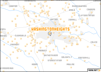
Washington Heights (South Carolina, United States - USA)Washington Heights is a town in the South Carolina region of United States - USA. An overview map of the region around Washington Heights is displayed below.
regional and 3d topo map of Washington Heights, United States - USA ::
Washington Heights airports ::
The nearest airport is AND - Andersen Anderson Rgnl, located 85.9 km south west of Washington Heights.
Other airports nearby include CLT - Charlotte Douglas Intl (96.0 km east), HKY - Hickory Rgnl (102.2 km north east), CAE - Colombia Columbia Metropolitan (134.2 km south east), SSC - Sumter Shaw Afb (172.4 km south east), Nearby towns ::
Park Hills (0.9km south west) //
Spartanburg (1.5km north east) //
Arkwright (1.8km south east) //
South Meadows Farms (2.6km south) //
Sherwood Acres (2.7km south) //
Little Vista Heights (2.6km east) //
Converse Heights (2.9km north east) //
Hayne Station (3.3km north west) //
Woodburn Hills (3.0km east) //
Fairview Heights (3.5km north east) //
Saxon (3.5km north west) //
Shannon Forest (3.6km south west) //
Evans Acres (4.0km south) //
Pinedale Acres (4.2km south east) //
Una (4.3km north west) //
Whitney Heights (4.6km north) //
Byron Terrace (4.2km south west) //
Drayton (4.6km north east) //
Canaan (5.1km south) //
Oak Hurst (4.3km east) //
Whitney (5.3km north) //
Hilltop (5.3km north west) //
Lawson (5.1km north east) //
East Spartanburg (4.6km east) //
Raintree (4.8km south west) //
Salem Estates (5.3km south west) //
Raynell (5.7km south) //
Arcadia (5.0km north west) //
West View (5.0km west) //
[all distances 'as the bird flies' and approximate] 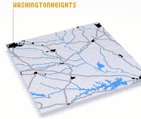 Places with similar names to Washington Heights, United States - USA ::
// Washington Heights (US)
// Washington Heights (US)
// Washington Heights (US)
// Washington Heights (US)
// Washington Heights (US)
// Washington Heights (US)
// Washington Heights (US)
// Washington Heights (US)
// Washington Heights (US)
// Washington Heights (US)
Disclaimer :: Information on this page comes without warranty of any kind |
||
|
Where is Washington Heights? Elevation and coordinates ::
Latitude (lat): 34°56'18"N Longitude (lon): 81°56'29"W
Elevation (approx.): 231m (map arrows pan, magnifying glasses zoom) |
||
|
Visiting Washington Heights? Hotel/Accommodation ::
Book a hotel in Washington Heights Travel Guide ::
rental cars ::
car rental offers GPS waypoint ::
download a GPX waypoint (PoI) of Washington Heights for your GPS receiver
|
||