|
search place name
|
||
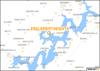
Eagle Point Heights (Tennessee, United States - USA)Eagle Point Heights is a town in the Tennessee region of United States - USA. An overview map of the region around Eagle Point Heights is displayed below.
regional and 3d topo map of Eagle Point Heights, United States - USA ::
Eagle Point Heights airports ::
The nearest airport is TYS - Knoxville Mc Ghee Tyson, located 67.2 km east of Eagle Point Heights.
Other airports nearby include CHA - Chattanooga Lovell Fld (91.4 km south west), BNA - Nashville Intl (179.8 km west), MGE - Marietta Dobbins Arb (Atlanta Nas) (206.0 km south), HUA - Redstone Aaf (214.5 km south west), Nearby towns ::
Eagle Point Cabin Area (0.4km south west) //
Eagle Furnace (0.8km north) //
Terrace View (1.7km south east) //
Pioneer Village (1.7km north east) //
Eagle Point (1.7km west) //
Reid Camp (2.3km north west) //
Apollo Shores (2.3km south west) //
Bella Mara Estates (2.7km east) //
Watts Bar Estates (3.3km south east) //
Eden of the Lake (3.9km south) //
Roddy (3.6km west) //
Cove Point (3.7km east) //
Glen Alice (4.7km north) //
Lakeside (6.1km south) //
Maple Grove (7.1km south east) //
Blue Springs (6.6km east) //
Blue Springs Resort (6.8km south east) //
Irwinton Shores (6.7km east) //
Smoke Rise (8.0km north) //
Half Moon Shores (7.1km south east) //
Bayside (6.9km east) //
Culvahouse (8.2km south east) //
Hillcrest (8.7km north) //
Saint Clair (7.4km south west) //
Meigs Cabin Area (8.8km south) //
Parkview (9.0km north east) //
Greivertown (9.5km north west) //
Eureka (10.4km north east) //
Dogwood (10.1km north west) //
[all distances 'as the bird flies' and approximate]  Places with similar names to Eagle Point Heights, United States - USA :: Disclaimer :: Information on this page comes without warranty of any kind |
||
|
Where is Eagle Point Heights? Elevation and coordinates ::
Latitude (lat): 35°45'50"N Longitude (lon): 84°44'7"W
Elevation (approx.): 249m (map arrows pan, magnifying glasses zoom) |
||
|
Visiting Eagle Point Heights? Hotel/Accommodation ::
Book a hotel in Eagle Point Heights Travel Guide ::
rental cars ::
car rental offers GPS waypoint ::
download a GPX waypoint (PoI) of Eagle Point Heights for your GPS receiver
|
||