|
search place name
|
||
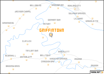
Griffintown (Tennessee, United States - USA)Griffintown is a town in the Tennessee region of United States - USA. An overview map of the region around Griffintown is displayed below.
regional and 3d topo map of Griffintown, United States - USA ::
Griffintown airports ::
The nearest airport is BNA - Nashville Intl, located 41.8 km east of Griffintown.
Other airports nearby include HOP - Hopkinsville Campbell Aaf (62.8 km north west), HUA - Redstone Aaf (171.8 km south), MKL - Jackson Mc Kellar Sipes Rgnl (173.1 km west), CHA - Chattanooga Lovell Fld (216.6 km south east), Nearby towns ::
Harpeth Valley (2.7km west) //
Petway (3.9km north) //
Germantown (5.2km north) //
Shacklett (7.3km south east) //
Bell Town (8.0km south) //
Claylick (7.6km west) //
Taylortown (8.4km south west) //
[all distances 'as the bird flies' and approximate] 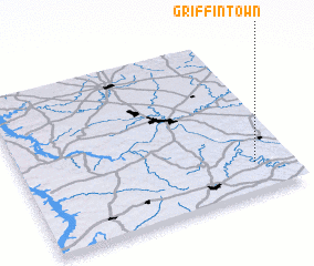 Places with similar names to Griffintown, United States - USA ::
// Gräfentonna (DE)
// Krivandino (RU)
// Krivandino (RU)
// Krivandino (RU)
// Karvandān (IR)
// Kraaifontein (ZA)
// Kerfeunteun (FR)
Disclaimer :: Information on this page comes without warranty of any kind |
||
|
Where is Griffintown? Elevation and coordinates ::
Latitude (lat): 36°10'57"N Longitude (lon): 87°8'15"W
Elevation (approx.): 168m (map arrows pan, magnifying glasses zoom) |
||
|
Visiting Griffintown? Hotel/Accommodation ::
Book a hotel in Griffintown Travel Guide ::
rental cars ::
car rental offers GPS waypoint ::
download a GPX waypoint (PoI) of Griffintown for your GPS receiver
|
||