|
search place name
|
||
Holston (Tennessee, United States - USA)Holston is a town in the Tennessee region of United States - USA. An overview map of the region around Holston is displayed below.
regional and 3d topo map of Holston, United States - USA ::

Holston airports ::
The nearest airport is HKY - Hickory Rgnl, located 122.8 km south east of Holston.
Other airports nearby include TYS - Knoxville Mc Ghee Tyson (161.9 km south west), CLT - Charlotte Douglas Intl (192.9 km south east), AND - Andersen Anderson Rgnl (222.7 km south), Nearby towns ::
Boring (3.7km south west) //
Gunnings (5.3km north) //
Fairview (4.3km east) //
Rocky Springs (5.1km south east) //
Sunrise Valley (5.8km north) //
Hobart Meadows (6.2km north west) //
Gross Crossroad (5.6km south east) //
Pettyjohn Mill (6.6km north west) //
Huddle Mill (6.2km north west) //
Indian Hills (7.2km north) //
Camp Placid (6.5km north east) //
Fall Creek (7.0km north west) //
Lake Park (6.8km north west) //
Woodrow (6.8km north west) //
Spurgeon (7.2km south west) //
New Bethel (7.8km south east) //
Harrtown (8.4km north) //
Oak Grove (8.6km south) //
Fox Fire (8.3km north west) //
Sunnyside (8.0km north west) //
Royal Pines (7.4km south west) //
Holiday Hills (8.3km north west) //
Bridwell Heights (8.6km north west) //
Blountville (8.3km north east) //
Mystic Valley (8.6km north west) //
Scenic Woods (8.6km north west) //
Oakview (9.5km north east) //
Thomas Heights (9.2km north west) //
Anderson (9.2km north east) //
[all distances 'as the bird flies' and approximate] 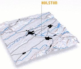 Places with similar names to Holston, United States - USA ::
Disclaimer :: Information on this page comes without warranty of any kind |
||
|
Where is Holston? Elevation and coordinates ::
Latitude (lat): 36°29'9"N Longitude (lon): 82°23'57"W
Elevation (approx.): 449m (map arrows pan, magnifying glasses zoom) |
||
|
Visiting Holston? Hotel/Accommodation ::
Book a hotel in Holston Travel Guide ::
rental cars ::
car rental offers GPS waypoint ::
download a GPX waypoint (PoI) of Holston for your GPS receiver
|
||