|
search place name
|
||
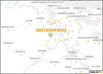
Montpier Farms (Tennessee, United States - USA)Montpier Farms is a town in the Tennessee region of United States - USA. An overview map of the region around Montpier Farms is displayed below.
regional and 3d topo map of Montpier Farms, United States - USA ::
Montpier Farms airports ::
The nearest airport is BNA - Nashville Intl, located 28.2 km north east of Montpier Farms.
Other airports nearby include HOP - Hopkinsville Campbell Aaf (90.9 km north west), HUA - Redstone Aaf (146.7 km south), MKL - Jackson Mc Kellar Sipes Rgnl (183.7 km west), CHA - Chattanooga Lovell Fld (189.4 km south east), Nearby towns ::
Forest Home (1.4km south east) //
Forest Home Farms (1.8km south west) //
Hunting Creek Farms (3.2km south west) //
Cottonwood Estates (3.0km south east) //
Settlers Point (4.0km south) //
Walnut Acres (3.8km east) //
Harpeth Estates (4.6km north) //
Dunkled Estates (4.7km north) //
Temple Hills Country Club Estates (4.8km north) //
Natchez Hills Estate (4.6km north west) //
Poplar Hills (5.0km north) //
Meadow Green Acres (4.2km east) //
Harpeth Hills (4.3km east) //
Berrys Chapel Heights (4.3km east) //
Trace End Estates (5.2km north) //
Sneed Glen (5.4km north) //
Longwood (5.5km north) //
Berrys Chapel (4.6km east) //
Pickens Acres (5.4km north east) //
Bethany Hills (5.7km north) //
Red Bud (6.0km north) //
Hunters Ridge (6.0km north) //
River Rest (5.3km north east) //
Battlewood Estates (5.0km east) //
Bethlehem (5.2km east) //
Grassland (5.2km east) //
Hunters Hill (6.2km north) //
Hillsboro Acres (5.3km east) //
Sneed Forest Estates (6.0km north east) //
[all distances 'as the bird flies' and approximate]  Places with similar names to Montpier Farms, United States - USA :: Disclaimer :: Information on this page comes without warranty of any kind |
||
|
Where is Montpier Farms? Elevation and coordinates ::
Latitude (lat): 35°59'4"N Longitude (lon): 86°56'20"W
Elevation (approx.): 221m (map arrows pan, magnifying glasses zoom) |
||
|
Visiting Montpier Farms? Hotel/Accommodation ::
Book a hotel in Montpier Farms Travel Guide ::
rental cars ::
car rental offers GPS waypoint ::
download a GPX waypoint (PoI) of Montpier Farms for your GPS receiver
|
||