|
search place name
|
||
Nickletown (Tennessee, United States - USA)Nickletown is a town in the Tennessee region of United States - USA. An overview map of the region around Nickletown is displayed below.
regional and 3d topo map of Nickletown, United States - USA ::

Nickletown airports ::
The nearest airport is CHA - Chattanooga Lovell Fld, located 36.2 km east of Nickletown.
Other airports nearby include HUA - Redstone Aaf (109.7 km south west), BNA - Nashville Intl (151.0 km north west), MGE - Marietta Dobbins Arb (Atlanta Nas) (163.7 km south east), TYS - Knoxville Mc Ghee Tyson (165.8 km north east), Nearby towns ::
Ebenezer (2.4km south east) //
Sequatchie (2.8km north) //
East Hill (3.4km south east) //
Jasper (3.4km south west) //
Rankin Cove (6.0km south) //
Mineral Springs (5.5km east) //
Glover Hill (6.1km south west) //
Inman (6.6km east) //
Victoria (7.9km north east) //
Haletown (8.6km south east) //
Oak Grove (8.2km north east) //
Kimball (8.5km south west) //
Ketner Mill (8.8km north east) //
[all distances 'as the bird flies' and approximate] 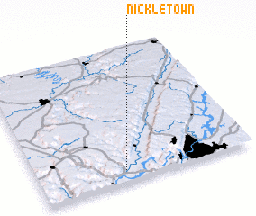 Places with similar names to Nickletown, United States - USA ::
// Ngaludon (MM)
// New Caledonia (US)
// Nickellton (US)
// Nāgaladinne (IN)
// Ngoultoune (SN)
// Nagallatan (PH)
Disclaimer :: Information on this page comes without warranty of any kind |
||
|
Where is Nickletown? Elevation and coordinates ::
Latitude (lat): 35°5'27"N Longitude (lon): 85°35'40"W
Elevation (approx.): 202m (map arrows pan, magnifying glasses zoom) |
||
|
Visiting Nickletown? Hotel/Accommodation ::
Book a hotel in Nickletown Travel Guide ::
rental cars ::
car rental offers GPS waypoint ::
download a GPX waypoint (PoI) of Nickletown for your GPS receiver
|
||