|
search place name
|
||
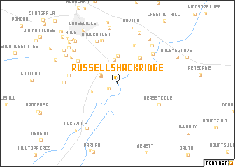
Russell Shack Ridge (Tennessee, United States - USA)Russell Shack Ridge is a town in the Tennessee region of United States - USA. An overview map of the region around Russell Shack Ridge is displayed below.
regional and 3d topo map of Russell Shack Ridge, United States - USA ::
Russell Shack Ridge airports ::
The nearest airport is TYS - Knoxville Mc Ghee Tyson, located 89.1 km east of Russell Shack Ridge.
Other airports nearby include CHA - Chattanooga Lovell Fld (95.0 km south), BNA - Nashville Intl (155.9 km west), HUA - Redstone Aaf (204.0 km south west), MGE - Marietta Dobbins Arb (Atlanta Nas) (221.1 km south), Nearby towns ::
Linary (1.4km south west) //
Dunrovin Estates (2.4km north west) //
Wild Plum (2.6km north west) //
Homestead (3.7km north) //
Pleasant View Estates (3.4km west) //
Highland View (4.4km north) //
Cumberland Homesteads (5.0km north east) //
Meridian (4.6km north east) //
Highland Estates (6.5km north) //
Rolling Hills (7.2km north) //
Mountain View Estates (6.5km north east) //
Parkway Estates (6.3km north west) //
Brookhaven (7.2km north) //
Grassy Cove (6.4km south east) //
Lake Tansi Village (6.4km west) //
Daddys Creek (7.5km north east) //
Heritage Estates (7.2km north west) //
Lake Tansi (6.9km west) //
Big Lick (8.2km south west) //
Otter Creek Junction (8.2km north east) //
Foxfire (7.7km north west) //
Bowling (8.6km north) //
Fairyland (8.0km north west) //
Livesay (8.7km north west) //
Middle Brook Place (8.5km north west) //
Volunteer Heights (8.8km north west) //
Oak Grove (9.2km south west) //
Shiloh (8.7km north west) //
Hale (9.2km north west) //
[all distances 'as the bird flies' and approximate] 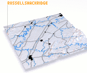 Places with similar names to Russell Shack Ridge, United States - USA :: Disclaimer :: Information on this page comes without warranty of any kind |
||
|
Where is Russell Shack Ridge? Elevation and coordinates ::
Latitude (lat): 35°52'18"N Longitude (lon): 84°58'40"W
Elevation (approx.): 555m (map arrows pan, magnifying glasses zoom) |
||
|
Visiting Russell Shack Ridge? Hotel/Accommodation ::
Book a hotel in Russell Shack Ridge Travel Guide ::
rental cars ::
car rental offers GPS waypoint ::
download a GPX waypoint (PoI) of Russell Shack Ridge for your GPS receiver
|
||