|
search place name
|
||
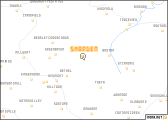
Smarden (Tennessee, United States - USA)Smarden is a town in the Tennessee region of United States - USA. An overview map of the region around Smarden is displayed below.
regional and 3d topo map of Smarden, United States - USA ::
Smarden airports ::
The nearest airport is BNA - Nashville Intl, located 48.8 km north east of Smarden.
Other airports nearby include HOP - Hopkinsville Campbell Aaf (99.8 km north), HUA - Redstone Aaf (133.1 km south), MKL - Jackson Mc Kellar Sipes Rgnl (167.8 km west), CHA - Chattanooga Lovell Fld (192.3 km south east), Nearby towns ::
Bethel (4.7km south west) //
Boston (4.7km east) //
Greenbrier (5.4km west) //
Theta (6.8km south east) //
McKnight (6.8km south west) //
Whiteoak (6.3km west) //
Beasley Crossroads (6.9km north west) //
Hill Town (8.8km south west) //
Fly (8.3km south west) //
[all distances 'as the bird flies' and approximate]  Places with similar names to Smarden, United States - USA ::
// Somerton (US)
// Summertown (US)
// Summertown (US)
// Symerton (US)
// Smerdyna (PL)
// Smrdan (BA)
// Smrdan (BA)
// Smŭrdan (BG)
// Ciomîrtan (RO)
// Smârdan (RO)
Disclaimer :: Information on this page comes without warranty of any kind |
||
|
Where is Smarden? Elevation and coordinates ::
Latitude (lat): 35°50'0"N Longitude (lon): 87°5'1"W
Elevation (approx.): 312m (map arrows pan, magnifying glasses zoom) |
||
|
Visiting Smarden? Hotel/Accommodation ::
Book a hotel in Smarden Travel Guide ::
rental cars ::
car rental offers GPS waypoint ::
download a GPX waypoint (PoI) of Smarden for your GPS receiver
|
||