|
search place name
|
||
Smokerise (Tennessee, United States - USA)Smokerise is a town in the Tennessee region of United States - USA. An overview map of the region around Smokerise is displayed below.
regional and 3d topo map of Smokerise, United States - USA ::

Smokerise airports ::
The nearest airport is TYS - Knoxville Mc Ghee Tyson, located 67.7 km south west of Smokerise.
Other airports nearby include AND - Andersen Anderson Rgnl (196.5 km south), CHA - Chattanooga Lovell Fld (207.2 km south west), Nearby towns ::
Melody Acres (0.7km north) //
Alpha (0.8km east) //
Prima Estates (1.0km north west) //
Alpha Heights (1.1km north) //
Willow Springs (1.1km north east) //
Panther Hills (1.3km north) //
Fox Den (1.2km north west) //
Buell Acres (1.5km south) //
Wood Acres (1.3km north east) //
Arrow Hills (1.5km west) //
Panther Lake (2.0km north) //
Meadowview (1.9km south west) //
Navaho Hills (1.8km west) //
Cedar Hills (2.0km south east) //
Seven Oaks (2.2km north) //
Jackson Heights (2.1km north west) //
Hunters Ridge (2.2km south west) //
Britton Acres (2.4km south west) //
Westgate (2.6km south west) //
Purkey Estates (2.4km west) //
Kathy Hills (2.4km west) //
Lake Park (2.9km north west) //
Green Acres (2.7km north west) //
Mapleview Acres (2.8km east) //
Woodcrest Hills (3.5km north) //
Talbott (3.3km south west) //
Beacon Hills (3.0km west) //
Briarcliff View (3.1km south west) //
Cedar Hill Park (3.2km north west) //
[all distances 'as the bird flies' and approximate] 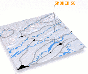 Places with similar names to Smokerise, United States - USA ::
// Smoke Rise (US)
// Smoke Rise (US)
// Smoke Rise (US)
// Smęgorzów (PL)
// Smogorzów (PL)
// Smogorzów (PL)
// Smogorzów (PL)
// Zemegresi (BA)
// Smoke Rise (US)
// Smokerise (US)
Disclaimer :: Information on this page comes without warranty of any kind |
||
|
Where is Smokerise? Elevation and coordinates ::
Latitude (lat): 36°10'30"N Longitude (lon): 83°23'30"W
Elevation (approx.): 409m (map arrows pan, magnifying glasses zoom) |
||
|
Visiting Smokerise? Hotel/Accommodation ::
Book a hotel in Smokerise Travel Guide ::
rental cars ::
car rental offers GPS waypoint ::
download a GPX waypoint (PoI) of Smokerise for your GPS receiver
|
||