|
search place name
|
||
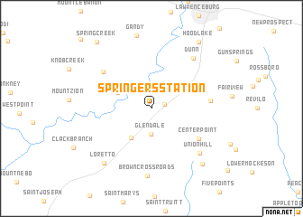
Springers Station (Tennessee, United States - USA)Springers Station is a town in the Tennessee region of United States - USA. An overview map of the region around Springers Station is displayed below.
regional and 3d topo map of Springers Station, United States - USA ::
Springers Station airports ::
The nearest airport is HUA - Redstone Aaf, located 82.0 km south east of Springers Station.
Other airports nearby include BNA - Nashville Intl (126.8 km north east), MKL - Jackson Mc Kellar Sipes Rgnl (148.0 km west), HOP - Hopkinsville Campbell Aaf (170.0 km north), BHM - Birmingham Intl (184.3 km south), Nearby towns ::
Pleasant Point (1.4km east) //
Glendale (3.2km south) //
Busby (4.1km south west) //
Long Branch (3.9km north west) //
Leoma (4.3km north east) //
Center Point (6.1km south east) //
Antioch (6.0km east) //
Crewstown (6.7km north west) //
Dunn (7.5km north east) //
Union Hill (7.4km south east) //
Brown Crossroads (8.3km south) //
Loretto (8.3km south west) //
Ramah (8.6km south east) //
Hood Lake (9.6km north east) //
Spring Creek (9.9km north west) //
Pea Ridge (11.2km north west) //
[all distances 'as the bird flies' and approximate] 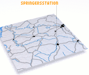 Places with similar names to Springers Station, United States - USA ::
// Springer Station (US)
Disclaimer :: Information on this page comes without warranty of any kind |
||
|
Where is Springers Station? Elevation and coordinates ::
Latitude (lat): 35°8'20"N Longitude (lon): 87°23'13"W
Elevation (approx.): 291m (map arrows pan, magnifying glasses zoom) |
||
|
Visiting Springers Station? Hotel/Accommodation ::
Book a hotel in Springers Station Travel Guide ::
rental cars ::
car rental offers GPS waypoint ::
download a GPX waypoint (PoI) of Springers Station for your GPS receiver
|
||