|
search place name
|
||
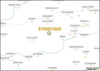
Stringtown (Tennessee, United States - USA)Stringtown is a town in the Tennessee region of United States - USA. An overview map of the region around Stringtown is displayed below.
regional and 3d topo map of Stringtown, United States - USA ::
Stringtown airports ::
The nearest airport is CHA - Chattanooga Lovell Fld, located 95.6 km south of Stringtown.
Other airports nearby include TYS - Knoxville Mc Ghee Tyson (118.5 km east), BNA - Nashville Intl (126.7 km west), HUA - Redstone Aaf (184.3 km south west), MGE - Marietta Dobbins Arb (Atlanta Nas) (230.8 km south), Nearby towns ::
Clarktown (4.5km north) //
Mobra (4.0km east) //
De Rossett (6.5km north) //
Lost Creek (5.7km west) //
Eastland (5.9km east) //
Bon Air (7.7km north west) //
Todd Town (7.2km east) //
Bethesda (8.7km south west) //
Smith Chapel (9.6km north east) //
White Oak Forest (9.5km north east) //
[all distances 'as the bird flies' and approximate] 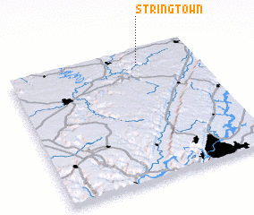 Places with similar names to Stringtown, United States - USA ::
// Stringtown (US)
// Stringtown (US)
// Stringtown (US)
// Stringtown (US)
// Stringtown (US)
// Stringtown (US)
// Stringtown (US)
// Stringtown (US)
// Stringtown (US)
// Stringtown (US)
Disclaimer :: Information on this page comes without warranty of any kind |
||
|
Where is Stringtown? Elevation and coordinates ::
Latitude (lat): 35°53'34"N Longitude (lon): 85°18'7"W
Elevation (approx.): 562m (map arrows pan, magnifying glasses zoom) |
||
|
Visiting Stringtown? Hotel/Accommodation ::
Book a hotel in Stringtown Travel Guide ::
rental cars ::
car rental offers GPS waypoint ::
download a GPX waypoint (PoI) of Stringtown for your GPS receiver
|
||