|
search place name
|
||
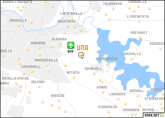
Una (Tennessee, United States - USA)Una is a town in the Tennessee region of United States - USA. An overview map of the region around Una is displayed below.
regional and 3d topo map of Una, United States - USA ::
Una airports ::
The nearest airport is BNA - Nashville Intl, located 3.7 km north west of Una.
Other airports nearby include HOP - Hopkinsville Campbell Aaf (98.6 km north west), HUA - Redstone Aaf (157.4 km south), CHA - Chattanooga Lovell Fld (176.6 km south east), FTK - Fort Knox Godman Aaf (209.8 km north), Nearby towns ::
Bakertown (3.4km south west) //
Rural Hill (4.0km south east) //
Antioch (4.4km south) //
Smith Springs (4.7km east) //
Glenview (5.3km north west) //
Mount View (5.7km south east) //
Cloverhill (6.6km north) //
Brooklin (6.3km south east) //
Mudtavern (6.9km north west) //
Donelson (7.4km north) //
Glencliff (6.4km north west) //
Merry Oaks (7.9km north) //
Providence (6.8km south west) //
Paragon Mills (6.7km west) //
Kimbro (8.4km south east) //
[all distances 'as the bird flies' and approximate]  Places with similar names to Una, United States - USA ::
Disclaimer :: Information on this page comes without warranty of any kind |
||
|
Where is Una? Elevation and coordinates ::
Latitude (lat): 36°5'50"N Longitude (lon): 86°39'17"W
Elevation (approx.): 206m (map arrows pan, magnifying glasses zoom) |
||
|
Visiting Una? Hotel/Accommodation ::
Book a hotel in Una Travel Guide ::
rental cars ::
car rental offers GPS waypoint ::
download a GPX waypoint (PoI) of Una for your GPS receiver
|
||