|
search place name
|
||
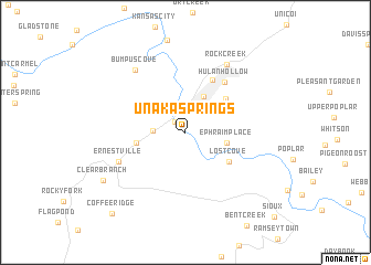
Unaka Springs (Tennessee, United States - USA)Unaka Springs is a town in the Tennessee region of United States - USA. An overview map of the region around Unaka Springs is displayed below.
regional and 3d topo map of Unaka Springs, United States - USA ::
Unaka Springs airports ::
The nearest airport is HKY - Hickory Rgnl, located 102.9 km east of Unaka Springs.
Other airports nearby include TYS - Knoxville Mc Ghee Tyson (143.6 km west), CLT - Charlotte Douglas Intl (167.4 km south east), AND - Andersen Anderson Rgnl (179.5 km south), Nearby towns ::
Chestoa (1.0km north) //
River Hill (1.4km north west) //
Love Station (2.6km north) //
Riverview (2.8km north) //
Shallowford (2.6km west) //
Banner Hill (4.0km north) //
Ephraim Place (3.6km east) //
Temple Hill (4.1km west) //
Lillydale (4.7km north east) //
Lost Cove (4.6km south east) //
Erwin (5.7km north east) //
Hulan Hollow (6.0km north east) //
Ernestville (6.2km south west) //
Rock Creek (7.6km north east) //
Bumpus Cove (7.5km north west) //
Clearbranch (8.3km south west) //
Coffee Ridge (10.2km south west) //
[all distances 'as the bird flies' and approximate] 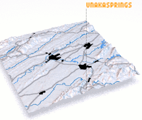 Places with similar names to Unaka Springs, United States - USA :: Disclaimer :: Information on this page comes without warranty of any kind |
||
|
Where is Unaka Springs? Elevation and coordinates ::
Latitude (lat): 36°5'51"N Longitude (lon): 82°26'30"W
Elevation (approx.): 539m (map arrows pan, magnifying glasses zoom) |
||
|
Visiting Unaka Springs? Hotel/Accommodation ::
Book a hotel in Unaka Springs Travel Guide ::
rental cars ::
car rental offers GPS waypoint ::
download a GPX waypoint (PoI) of Unaka Springs for your GPS receiver
|
||