|
search place name
|
||
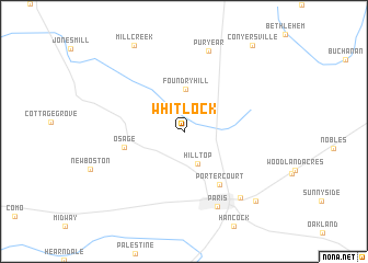
Whitlock (Tennessee, United States - USA)Whitlock is a town in the Tennessee region of United States - USA. An overview map of the region around Whitlock is displayed below.
regional and 3d topo map of Whitlock, United States - USA ::
Whitlock airports ::
The nearest airport is HOP - Hopkinsville Campbell Aaf, located 83.9 km north east of Whitlock.
Other airports nearby include MKL - Jackson Mc Kellar Sipes Rgnl (99.3 km south west), BYH - Blytheville Arkansas Intl (149.7 km west), BNA - Nashville Intl (153.3 km east), NQA - Millington Rgnl Jetport (177.0 km south west), Nearby towns ::
Hilltop (3.5km south) //
Foundry Hill (4.3km north) //
Osage (5.2km west) //
Porter Court (6.1km south east) //
Paris (8.1km south) //
Puryear (8.4km north) //
Chickasaw Heights (8.1km south east) //
Mill Creek (9.6km north west) //
Meadow Mead (9.2km south east) //
Conyersville (10.4km north east) //
[all distances 'as the bird flies' and approximate]  Places with similar names to Whitlock, United States - USA ::
// Hoddelke (DE)
// Hidalgo (US)
// Hattelek (HU)
// Hidalgo (ES)
// Hidalgo (US)
// White Lake (US)
// White Lake (US)
// Hot Lake (US)
// Hood Lake (US)
// Hidalgo (US)
Disclaimer :: Information on this page comes without warranty of any kind |
||
|
Where is Whitlock? Elevation and coordinates ::
Latitude (lat): 36°22'15"N Longitude (lon): 88°21'25"W
Elevation (approx.): 164m (map arrows pan, magnifying glasses zoom) |
||
|
Visiting Whitlock? Hotel/Accommodation ::
Book a hotel in Whitlock Travel Guide ::
rental cars ::
car rental offers GPS waypoint ::
download a GPX waypoint (PoI) of Whitlock for your GPS receiver
|
||