|
search place name
|
||
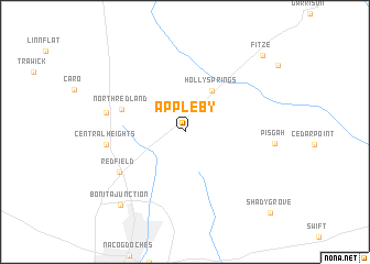
Appleby (Texas, United States - USA)Appleby is a town in the Texas region of United States - USA. An overview map of the region around Appleby is displayed below.
regional and 3d topo map of Appleby, United States - USA ::
Appleby airports ::
The nearest airport is GGG - Longview East Texas Rgnl, located 74.7 km north of Appleby.
Other airports nearby include TYR - Tyler Pounds Rgnl (103.4 km north west), SHV - Shreveport Rgnl (109.4 km north east), BAD - Shreveport Barksdale Afb (124.5 km north east), POE - Fort Polk Polk Aaf (153.6 km south east), Nearby towns ::
Holly Springs (4.8km north east) //
North Redland (6.0km north west) //
Redfield (7.0km south west) //
Central Heights (6.9km west) //
Mahl (7.0km west) //
Bonita Junction (9.3km south west) //
Fitze (10.2km north east) //
Shady Grove (11.1km south east) //
[all distances 'as the bird flies' and approximate] 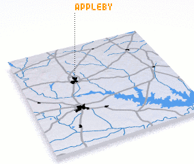 Places with similar names to Appleby, United States - USA ::
// Appleby (US)
// Appleby (NZ)
// Appleby (US)
// Appleby (BB)
// Ấp Phú Lợi (1) (VN)
// Ấp Phù Lý (1) (VN)
// Apollo Bay (AU)
// Appleby (AU)
// Äppelbo (SE)
// Appelby (SE)
Disclaimer :: Information on this page comes without warranty of any kind |
||
|
Where is Appleby? Elevation and coordinates ::
Latitude (lat): 31°42'58"N Longitude (lon): 94°36'17"W
Elevation (approx.): 131m (map arrows pan, magnifying glasses zoom) |
||
|
Visiting Appleby? Hotel/Accommodation ::
Book a hotel in Appleby Travel Guide ::
rental cars ::
car rental offers GPS waypoint ::
download a GPX waypoint (PoI) of Appleby for your GPS receiver
|
||