|
search place name
|
||
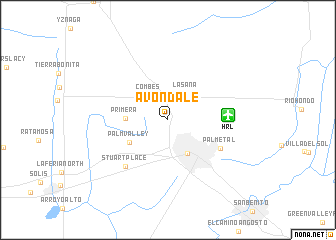
Avondale (Texas, United States - USA)Avondale is a town in the Texas region of United States - USA. An overview map of the region around Avondale is displayed below.
regional and 3d topo map of Avondale, United States - USA ::
Avondale airports ::
The nearest airport is HRL - Harlingen Valley Intl, located 6.1 km east of Avondale.
Other airports nearby include BRO - Brownsville South Padre Island Intl (45.5 km south east), MFE - Mcallen Mc Allen Miller Intl (52.6 km west), MAM - Matamoros General Servando Canales Intl (53.8 km south), REX - Reynosa General Lucio Blanco Intl (56.6 km south west), Nearby towns ::
Combes (3.2km north west) //
Lasana (3.4km north east) //
Harlingen (4.2km south east) //
Primera (4.2km west) //
Palm Valley (4.6km south west) //
Palmetal (6.1km south east) //
Stuart Place (6.7km south west) //
[all distances 'as the bird flies' and approximate] 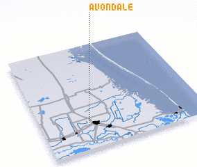 Places with similar names to Avondale, United States - USA ::
Disclaimer :: Information on this page comes without warranty of any kind |
||
|
Where is Avondale? Elevation and coordinates ::
Latitude (lat): 26°13'27"N Longitude (lon): 97°42'55"W
Elevation (approx.): 16m (map arrows pan, magnifying glasses zoom) |
||
|
Visiting Avondale? Hotel/Accommodation ::
Book a hotel in Avondale Travel Guide ::
rental cars ::
car rental offers GPS waypoint ::
download a GPX waypoint (PoI) of Avondale for your GPS receiver
|
||