|
search place name
|
||
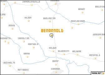
Ben Arnold (Texas, United States - USA)Ben Arnold is a town in the Texas region of United States - USA. An overview map of the region around Ben Arnold is displayed below.
regional and 3d topo map of Ben Arnold, United States - USA ::
Ben Arnold airports ::
The nearest airport is HLR - Fort Hood Hood Aaf, located 72.0 km west of Ben Arnold.
Other airports nearby include CLL - College Station Easterwood Fld (72.8 km south east), ACT - Waco Rgnl (75.4 km north), GRK - Killeen Robert Gray Aaf (81.1 km west), AUS - Austin Bergstrom Intl (107.5 km south west), Nearby towns ::
Splawn (4.9km south) //
Burlington (5.8km north) //
Silver City (7.0km south east) //
North Elm (6.7km south west) //
Clarkson (7.0km north east) //
Wilson (9.5km north west) //
Belmena (9.7km south east) //
[all distances 'as the bird flies' and approximate]  Places with similar names to Ben Arnold, United States - USA :: Disclaimer :: Information on this page comes without warranty of any kind |
||
|
Where is Ben Arnold? Elevation and coordinates ::
Latitude (lat): 30°57'49"N Longitude (lon): 96°59'16"W
Elevation (approx.): 125m (map arrows pan, magnifying glasses zoom) |
||
|
Visiting Ben Arnold? Hotel/Accommodation ::
Book a hotel in Ben Arnold Travel Guide ::
rental cars ::
car rental offers GPS waypoint ::
download a GPX waypoint (PoI) of Ben Arnold for your GPS receiver
|
||