|
search place name
|
||
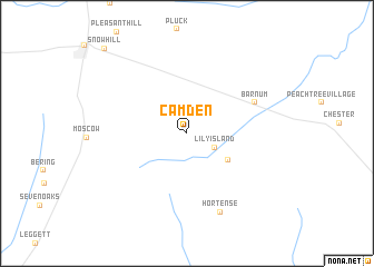
Camden (Texas, United States - USA)Camden is a town in the Texas region of United States - USA. An overview map of the region around Camden is displayed below.
regional and 3d topo map of Camden, United States - USA ::
Camden airports ::
The nearest airport is CXO - Conroe Lone Star Executive, located 90.4 km south west of Camden.
Other airports nearby include IAH - George Bush Intcntl Houston (118.7 km south west), BPT - Beaumont Southeast Texas Rgnl (127.2 km south east), DRI - Deridder Beauregard Rgnl (133.7 km east), POE - Fort Polk Polk Aaf (148.0 km east), Nearby towns ::
Lily Island (2.8km south east) //
Barnes (4.5km south east) //
Barnum (6.6km north east) //
Hortense (8.4km south) //
Snow Hill (11.1km north west) //
[all distances 'as the bird flies' and approximate] 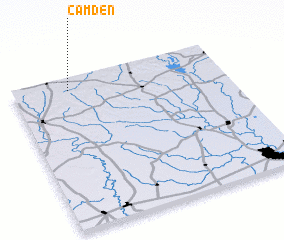 Places with similar names to Camden, United States - USA ::
Disclaimer :: Information on this page comes without warranty of any kind |
||
|
Where is Camden? Elevation and coordinates ::
Latitude (lat): 30°55'1"N Longitude (lon): 94°44'3"W
Elevation (approx.): 94m (map arrows pan, magnifying glasses zoom) |
||
|
Visiting Camden? Hotel/Accommodation ::
Book a hotel in Camden Travel Guide ::
rental cars ::
car rental offers GPS waypoint ::
download a GPX waypoint (PoI) of Camden for your GPS receiver
|
||