|
search place name
|
||
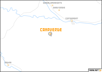
Camp Verde (Texas, United States - USA)Camp Verde is a town in the Texas region of United States - USA. An overview map of the region around Camp Verde is displayed below.
regional and 3d topo map of Camp Verde, United States - USA ::
Camp Verde airports ::
The nearest airport is SAT - San Antonio Intl, located 73.2 km south east of Camp Verde.
Other airports nearby include SKF - San Antonio Lackland Afb Kelly Fld Annex (75.9 km south east), RND - San Antonio Randolph Afb (89.5 km south east), AUS - Austin Bergstrom Intl (142.3 km east), DLF - Del Rio Laughlin Afb (172.5 km west), Nearby towns ::
Center Point (8.6km north east) //
[all distances 'as the bird flies' and approximate] 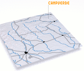 Places with similar names to Camp Verde, United States - USA ::
// Camp Verde (US)
// Campo Verde (MX)
// Campo Verde (MX)
// Campo Verde (PE)
// Campo Verde (PE)
// Campoverde (PE)
// Campo Verde (VE)
// Campo Verde (VE)
// Camp Fort (HT)
// Campofiorito (IT)
Disclaimer :: Information on this page comes without warranty of any kind |
||
|
Where is Camp Verde? Elevation and coordinates ::
Latitude (lat): 29°53'37"N Longitude (lon): 99°6'16"W
Elevation (approx.): 497m (map arrows pan, magnifying glasses zoom) |
||
|
Visiting Camp Verde? Hotel/Accommodation ::
Book a hotel in Camp Verde Travel Guide ::
rental cars ::
car rental offers GPS waypoint ::
download a GPX waypoint (PoI) of Camp Verde for your GPS receiver
|
||