|
search place name
|
||
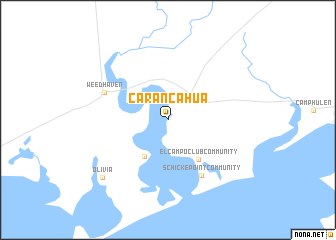
Carancahua (Texas, United States - USA)Carancahua is a town in the Texas region of United States - USA. An overview map of the region around Carancahua is displayed below.
regional and 3d topo map of Carancahua, United States - USA ::
Carancahua airports ::
The nearest airport is CRP - Corpus Christi Intl, located 149.8 km south west of Carancahua.
Other airports nearby include HOU - Houston William P Hobby (150.8 km north east), GLS - Scholes Intl At Galveston (161.8 km north east), IAH - George Bush Intcntl Houston (175.3 km north east), NQI - Kingsville Nas (192.0 km south west), Nearby towns ::
Port Alto (4.7km south west) //
El Campo Club Community (5.3km south east) //
Schicke Point Community (7.0km south east) //
Weedhaven (6.9km north west) //
Olivia (9.1km south west) //
[all distances 'as the bird flies' and approximate] 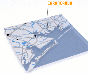 Places with similar names to Carancahua, United States - USA ::
Disclaimer :: Information on this page comes without warranty of any kind |
||
|
Where is Carancahua? Elevation and coordinates ::
Latitude (lat): 28°41'47"N Longitude (lon): 96°23'22"W
Elevation (approx.): 5m (map arrows pan, magnifying glasses zoom) |
||
|
Visiting Carancahua? Hotel/Accommodation ::
Book a hotel in Carancahua Travel Guide ::
rental cars ::
car rental offers GPS waypoint ::
download a GPX waypoint (PoI) of Carancahua for your GPS receiver
|
||