|
search place name
|
||
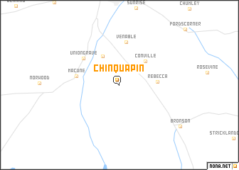
Chinquapin (Texas, United States - USA)Chinquapin is a town in the Texas region of United States - USA. An overview map of the region around Chinquapin is displayed below.
regional and 3d topo map of Chinquapin, United States - USA ::
Chinquapin airports ::
The nearest airport is POE - Fort Polk Polk Aaf, located 95.1 km south east of Chinquapin.
Other airports nearby include DRI - Deridder Beauregard Rgnl (96.2 km south east), SHV - Shreveport Rgnl (118.6 km north), GGG - Longview East Texas Rgnl (123.3 km north west), BAD - Shreveport Barksdale Afb (128.7 km north), Nearby towns ::
Maxey Town (5.0km north west) //
Conville (5.1km north east) //
Rebecca (5.1km east) //
Venable (6.9km north) //
Macune (6.0km west) //
Union Grave (6.4km north west) //
[all distances 'as the bird flies' and approximate] 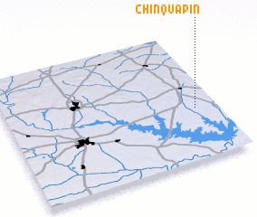 Places with similar names to Chinquapin, United States - USA ::
// Chinquapin (US)
// Chinquapin (US)
// Chinquapin (US)
// Chinquapin (US)
// Chinquapin (US)
// Sīānak-e Pā'īn (IR)
// Chŏngp'an (KP)
// Ch'ang-p'an (TW)
// Ch'ang-pin (TW)
// Ch'ang-pin (TW)
Disclaimer :: Information on this page comes without warranty of any kind |
||
|
Where is Chinquapin? Elevation and coordinates ::
Latitude (lat): 31°24'10"N Longitude (lon): 94°5'57"W
Elevation (approx.): 102m (map arrows pan, magnifying glasses zoom) |
||
|
Visiting Chinquapin? Hotel/Accommodation ::
Book a hotel in Chinquapin Travel Guide ::
rental cars ::
car rental offers GPS waypoint ::
download a GPX waypoint (PoI) of Chinquapin for your GPS receiver
|
||